Matrice 4 for Remote Venue Capture: What Actually Matters
Matrice 4 for Remote Venue Capture: What Actually Matters in the Field
META: A field-tested Matrice 4 case study on capturing remote venues with reliable transmission, thermal awareness, photogrammetry accuracy, and faster deployment workflows.
A remote venue shoot looks simple on the brief and messy in real life.
You get a mountain lodge, an island resort, a vineyard event space, or an outdoor amphitheater two hours beyond dependable cell coverage. The client wants hero footage, mapping outputs for planning, and enough visual detail to support future operations. They also want it done in one visit, because hauling crews back to a hard-to-reach site burns time fast.
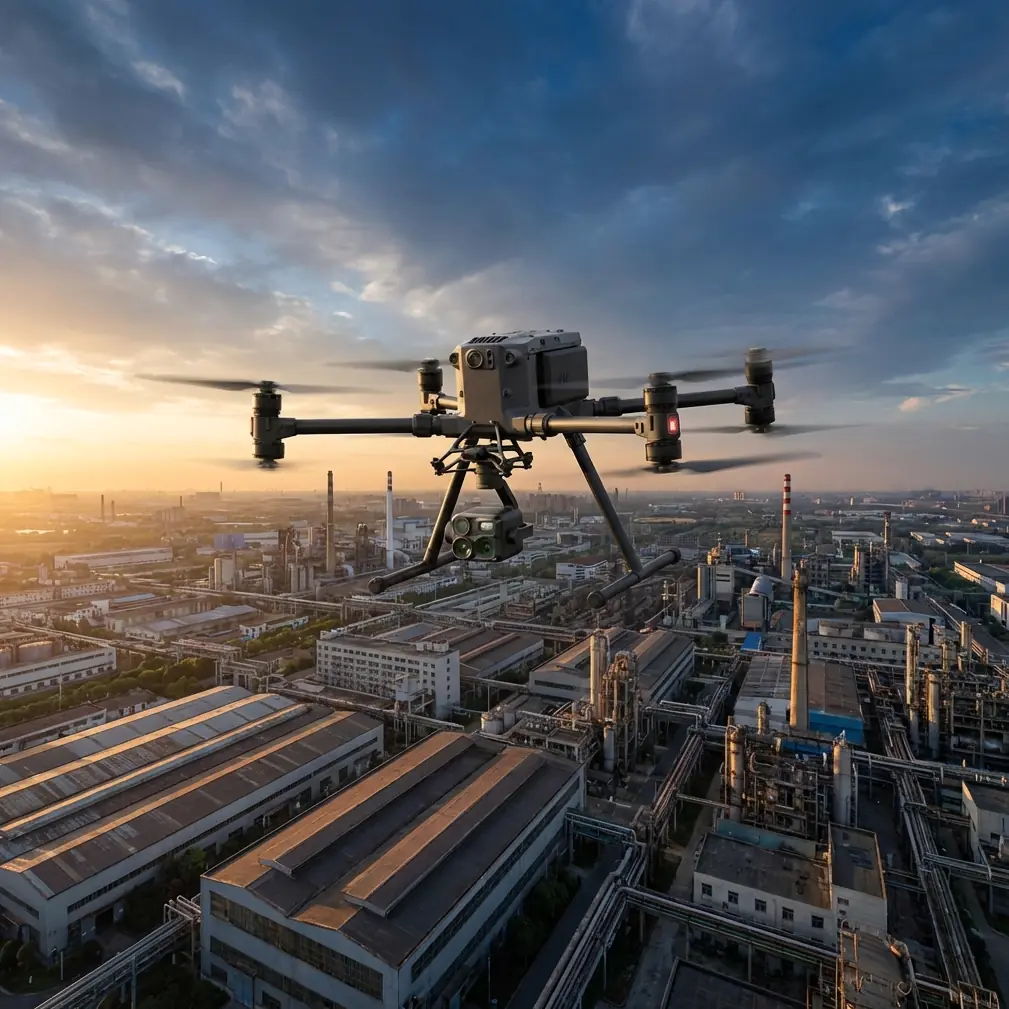
That is where the Matrice 4 starts to separate itself from aircraft that look fine on a spec sheet but become awkward when the job turns technical.
I learned that the hard way on an earlier venue capture project in a remote valley. The location was ideal for weddings and seasonal events, but terrible for flight logistics. Wind funneled through the ridgeline. The takeoff area was cramped. Signal confidence dropped the moment the aircraft crossed behind a stand of trees. We were not doing anything exotic—just trying to build a dependable package of aerial stills, orthomosaic data, and site intelligence for the venue owner. Yet the workflow kept slowing down because the aircraft and transmission chain demanded too much babysitting.
The Matrice 4 changes that equation in practical ways. Not flashy ways. Operationally useful ways.
The real problem with remote venue capture
Remote venues are rarely just “beautiful places.” They are also communication dead zones, awkward launch environments, and properties with mixed priorities. One pass may be about marketing imagery. The next may be about drainage, roof condition, access roads, parking overflow, tree encroachment, or utility routing for temporary event infrastructure.
That means one aircraft often has to support two very different jobs:
- cinematic capture for the client-facing side of the venue
- structured data collection for planning, maintenance, and documentation
If your platform forces you to split those jobs across separate systems, the day gets inefficient quickly. More battery swaps. More gear. More setup friction. More chances to miss the weather window.
The Matrice 4 is especially strong when the operator needs to move between visual storytelling and measurable site documentation without rebuilding the whole workflow.
Why current drone expertise suddenly matters more
One detail from the reference material stood out: on 2026-03-10, Volodymyr Zelensky said allied countries were asking Ukraine for help in countering drones, calling it a “good feeling” that partners were seeking that expertise. Strip away the conflict context and one broader truth remains relevant to civilian operations: real drone knowledge is no longer theoretical. The world is paying attention to teams that understand signal discipline, aircraft behavior, and mission reliability under pressure.
That matters even for something as commercially ordinary as venue capture.
Remote venue work punishes weak operational habits. Transmission issues, poor battery planning, sloppy route design, and bad site awareness become visible immediately when you are far from backup equipment and easy re-access. The significance of that news detail is not about importing a military frame into a civilian discussion. It is about recognizing that drone professionalism now carries more weight. Experience in controlling the aircraft, protecting links, and extracting reliable outputs is becoming a differentiator across the entire UAV sector.
For Matrice 4 operators, that translates into a simple standard: fly with the same seriousness you would bring to any critical commercial mission. Build for resilience, not convenience.
A Matrice 4 workflow that suits remote venues
On remote venue assignments, I tend to break the Matrice 4 mission into four phases.
1. Fast reconnaissance
The first flight is not for beauty shots. It is for orientation.
I want to see access roads, topographic shifts, wind exposure, tree lines, antenna shadows, and where guests or staff are likely to move during active operations. This is where dependable O3 transmission earns its keep. In remote terrain, clean link performance is not a luxury. It is what lets you maintain composure while repositioning around structures, vegetation, and elevation changes.
People often talk about transmission as if it matters only at long distance. That misses the point. At venues, the more common issue is signal interruption caused by terrain and obstructions, not extreme range. A robust transmission system improves confidence in the exact kinds of medium-distance, line-compromised maneuvers that happen when documenting a property with pavilions, slopes, tree cover, and outbuildings.
2. Structured photogrammetry
Once I understand the site, I switch from exploration to repeatability.
For many venue owners, the most valuable deliverable is not the cinematic edit. It is the base map and measurable model that can be used for planning. Photogrammetry gives them that. They can evaluate parking expansion, tent placements, emergency egress routes, drainage paths, and landscape maintenance with far more precision than they get from ground photos alone.
This is also where GCP discipline matters. Ground control points are not glamorous, but they improve confidence in the final map and model. If a venue intends to use outputs for layout planning or contractor coordination, poor spatial accuracy becomes expensive later. The Matrice 4 fits well into this kind of workflow because it can move from broad capture to systematic collection without feeling like a compromise platform.
For remote venues, I generally care less about making the map look pretty and more about whether it answers operational questions. Can the service road handle larger delivery vehicles? Where does standing water collect after rain? How close are tree canopies to string-light corridors or temporary structures? Those are business questions, and photogrammetry turns them into measurable ones.
3. Thermal verification where it helps
Thermal is one of the most misunderstood tools in venue capture. It is not there to create dramatic imagery for its own sake. It is there to reveal patterns that standard visual imaging can miss.
On remote properties, thermal signature checks can be useful for identifying roof moisture suspicion, electrical hot spots around utility installations, HVAC irregularities, and sometimes water movement patterns near structures. For resorts, eco-lodges, and event properties that operate with limited maintenance windows, that kind of data can justify the flight on its own.
The key is judgment. Thermal should answer a question. If the venue manager suspects a recurring issue in a utility corridor or building envelope, the Matrice 4 can make that inspection phase part of the same deployment rather than a separate visit. That matters when travel time is long and site access is inconsistent.
4. Efficient turnaround in the field
Remote sites expose every weakness in your battery workflow.
Hot-swap batteries are one of those features that sound incremental until you are on a ridge with changing light, a waiting client, and only a short calm-weather window. Then they become central to mission continuity. The less downtime between flights, the easier it is to preserve momentum, maintain scene consistency, and finish the full capture plan before conditions shift.
This is especially valuable when you are combining marketing visuals with mapping. Those are different flight profiles. Different altitudes, different pacing, different priorities. Without a streamlined power workflow, the team loses rhythm between modes.
Security and confidence are not abstract concerns
Another reference detail matters here: the source text emphasized help in “countering drones.” In the civilian world, the operational takeaway is not confrontation. It is awareness.
Remote venues are increasingly privacy-sensitive environments. Luxury retreats, private event spaces, and exclusive properties want high-quality aerial outputs without unnecessary exposure of flight data, client information, or mission records. That is why secure workflows matter more than many operators admit.
AES-256 support is significant because commercial operators are no longer just delivering images. They are collecting location data, site layouts, and operational details that clients may regard as sensitive. For a venue owner planning expansions or handling high-profile events, protecting that information is part of professional service.
The value is simple: security features support trust. Trust supports repeat work.
Where Matrice 4 makes the day easier
What surprised me most after shifting remote venue assignments onto the Matrice 4 was not raw image quality. It was how much less cognitive load the aircraft created.
That changes the operator’s day in several ways:
- You spend less energy managing link anxiety and more energy composing useful flight paths.
- You can collect photogrammetry outputs and visual assets in the same session without feeling like one mode disrupts the other.
- Thermal checks become a practical add-on instead of a separate specialist trip.
- Battery transitions interfere less with timing-sensitive shots and structured capture patterns.
Those savings compound. On a remote site, every friction point expands. Every solved problem creates room for better decisions.
A realistic case study example
Take a destination venue in uneven terrain with a central lodge, several detached guest structures, an outdoor ceremony platform, and a lower service road that floods seasonally. The owner wants three deliverables from one field day:
- aerial media for the website and booking deck
- a map for future parking redesign
- a quick inspection pass on utility areas before peak season
With the Matrice 4, the mission can be sequenced logically.
Start with reconnaissance to identify wind corridors and signal-blocking terrain. Move into photogrammetry with properly placed GCPs around the main guest and service zones. Then collect low-angle visual passes during favorable light. Finish with targeted thermal checks near roofs, utility boxes, and drainage trouble spots.
That single deployment does not just create content. It creates decision support.
And when the venue is remote, combining those outcomes in one visit is the difference between a profitable drone operation and one that leaks margin every time the road gets rough.
What operators should stop doing
A lot of pilots still approach venue capture as a lightweight creative job. That mindset leaves value on the table.
If you are flying a Matrice 4 into remote venues, stop treating the mission as just a reel shoot. Build a repeatable commercial workflow instead:
- plan visual and mapping outputs together
- use GCPs when the final data needs to support layout decisions
- reserve thermal for real inspection questions
- manage transmission quality as a mission-critical variable
- treat onboard and link security as part of client service
This is where the broader drone industry is heading. Expertise is increasingly measured by whether you can produce dependable outputs in imperfect conditions, not whether you can capture one attractive orbit around a building.
When the aircraft becomes part of the conversation
There is a subtle shift that happens when you bring the right platform to a remote venue job. The client stops asking only for footage and starts asking better questions.
Can we use this map to plan shuttle flow?
Can we verify whether that outbuilding is overheating near the electrical feed?
Can we compare the event lawn grade before and after drainage work?
Can we model guest circulation between ceremony and reception zones?
That is when the aircraft is no longer just a camera carrier. It becomes a working asset in the client’s planning process.
If you want to talk through a site-specific workflow before you head out, this direct WhatsApp line is useful for field coordination: https://wa.me/85255379740
Final take
The Matrice 4 is at its best in remote venue capture when the mission is treated as more than content creation. Its real value shows up when one deployment needs to support imagery, mapping, inspection, and operational confidence without wasting site access or daylight.
The reference material points to something larger happening in the drone sector: experienced teams are being recognized for practical knowledge under real-world conditions. That same standard applies in civilian work. On a remote venue assignment, professionalism is not an abstract idea. It shows up in transmission reliability, secure handling of data, disciplined photogrammetry, intelligent use of thermal signature information, and fast battery management when the weather window is tight.
That is why the Matrice 4 earns its place. Not because it promises everything. Because on the jobs that punish inefficiency, it removes enough friction to let skilled operators do better work.
Ready for your own Matrice 4? Contact our team for expert consultation.