Matrice 4 vineyard capture in urban edges: range
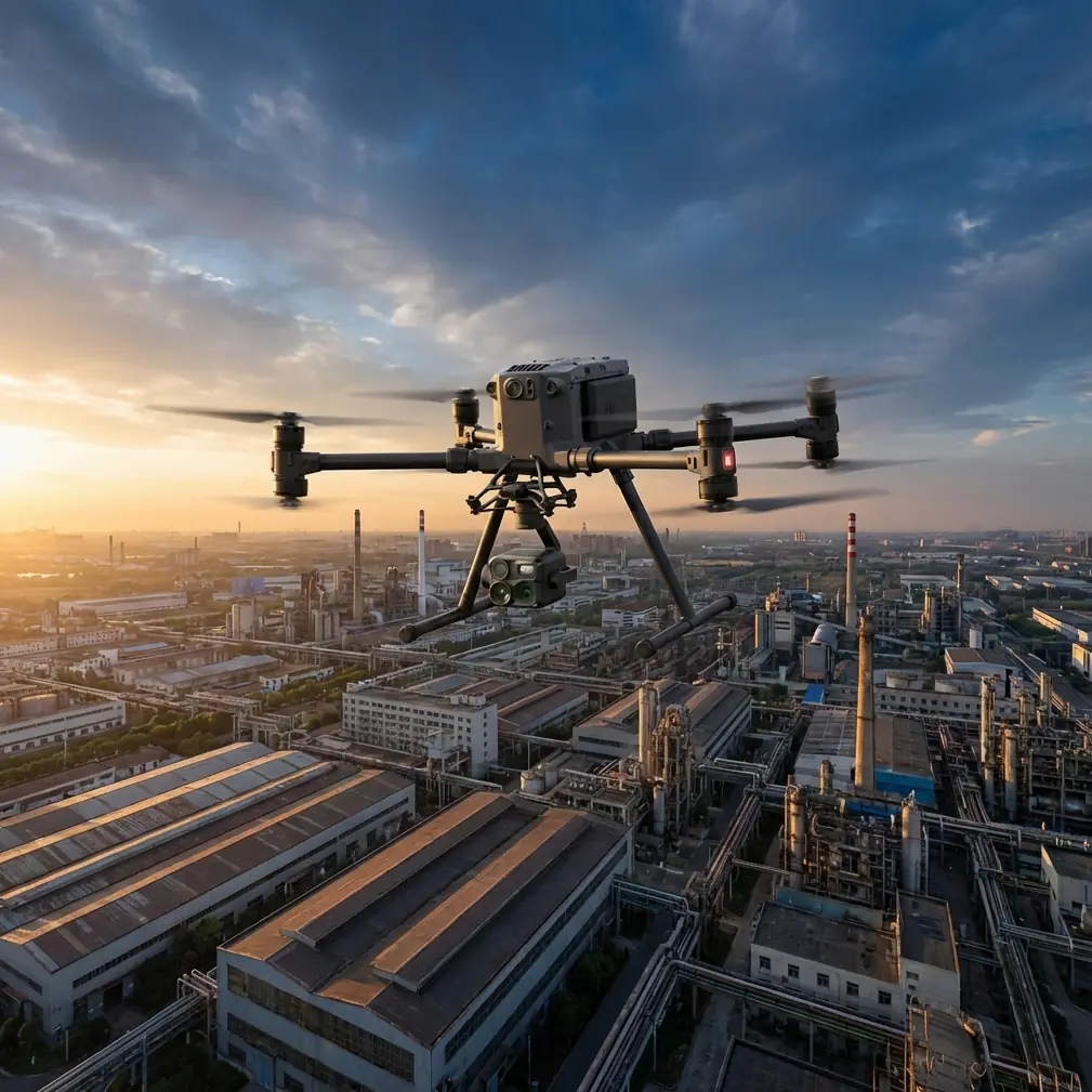
Matrice 4 vineyard capture in urban edges: range, wiring discipline, and airflow lessons that actually matter
META: Practical Matrice 4 vineyard imaging tips for urban environments, including antenna positioning, reliable data collection, wiring logic, and airflow-inspired thinking for safer, cleaner missions.
Urban-edge vineyards are awkward places to fly.
They look open from a distance, but once you begin planning a real Matrice 4 mission, the friction shows up fast: reflective roofs, narrow access lanes, intermittent signal blockage, heat shimmer off nearby buildings, and a patchwork of trees, wires, sheds, and trellis geometry that punishes lazy flight planning. Add the need for repeatable photogrammetry or thermal signature review, and “just get it in the air” stops being a serious method.
What makes the Matrice 4 interesting in this setting is not one headline feature. It is the way small technical decisions stack. Antenna orientation affects usable range. Marking and cable discipline affect troubleshooting speed. Even the way we think about airflow and obstructions can improve consistency around structures. Those ideas may sound unrelated. They are not.
I want to frame this the way an experienced operator should: not as a list of specs, but as a mission system.
Start with the urban vineyard problem, not the drone
Vineyards near towns create a mixed radio and thermal environment. You may be mapping vine vigor in the morning, checking irrigation anomalies by midday, and returning for low-angle visual capture later. The aircraft is moving through changing signal conditions and changing microclimates, often on a site where every row matters and every refly costs time.
For Matrice 4 operators, that means the priority is not raw speed. It is stable, repeatable collection.
If your end product is orthomosaic output, plant-stress interpretation, or row-by-row documentation, then the aircraft has to do three things well:
- Hold a predictable link in a cluttered RF environment
- Capture clean, reconstructable image sets
- Make post-flight fault isolation easy when something behaves oddly
That third point gets ignored until a cable issue, accessory fault, or field modification burns half a day.
Antenna positioning advice for maximum range
Let’s deal with the part most crews ask about first.
In urban-edge vineyard work, maximum range is rarely about flying as far as possible. It is about preserving link quality as the aircraft moves laterally behind vine blocks, farm structures, edge trees, and neighboring buildings. That makes antenna positioning more important than many pilots think.
With O3-class transmission workflows, the practical rule is simple: aim the broad face of the controller antennas toward the aircraft’s operating area, not the antenna tips. A surprising number of pilots still point the ends directly at the drone, which weakens the link at the exact moment they need margin. When the Matrice 4 is working row passes across a vineyard, especially off to one side of the pilot rather than directly ahead, re-angle the controller to keep that broadside relationship intact throughout the mission.
A few habits help:
- Stand where you can see above the nearest trellis and vehicle line, not merely where it is convenient to launch.
- Avoid setting up beside metal sheds, parked trucks, chain-link fencing, or rooftop HVAC clutter if you have a better option.
- If the vineyard sits below surrounding buildings, move upslope or to a cleaner edge so the transmission path is not skimming through structural interference.
- During long lateral mapping legs, rotate your body and controller with the aircraft rather than locking into one stance.
This sounds basic. It is not trivial in urban vineyard blocks, where the signal path can degrade in a very localized way. A pilot may see strong telemetry at takeoff, then encounter a dead patch near a corner where rows run close to a wall or a cluster of reflective surfaces. Good antenna discipline gives you more usable headroom before that weak zone becomes a mission interruption.
If you need help tuning field setup for a specific site layout, sharing a vineyard map with a specialist before flight can save a lot of trial and error; I’ve seen crews resolve these issues quickly through a direct pre-mission chat.
Why an old aircraft intake lesson applies to your vineyard flights
One of the reference materials behind this article comes from aircraft engine intake design. At first glance, that seems far removed from a Matrice 4 in a vineyard. Stay with me.
The source highlights that intake testing is not just about flow volume. It also examines total pressure recovery, outlet flow distortion, local flow behavior, drag, and compatibility between the intake and the engine. That mindset matters for drone operations around urban agriculture because airflow near structures is never uniform. The important takeaway is not the specific aircraft application. It is the engineering principle: systems fail or degrade at the interfaces.
In vineyard capture, the equivalent interfaces are:
- aircraft and local wind field
- sensor and reflected heat
- transmission link and built environment
- flight path and row geometry
Why does this matter operationally?
Because when a Matrice 4 produces inconsistent imagery over the same block, operators often blame the camera or processing first. But on mixed urban-ag sites, the cause is frequently environmental distortion: rotor wash interacting with tight spaces, gusts spilling over walls, or unstable hover conditions near structures that slightly alter image overlap and angle consistency.
The aircraft handbook excerpt also notes the importance of detailed distribution data, including pressure and flow direction. In field terms, that’s your reminder to study not just forecast wind speed, but how air is being redirected by neighboring buildings, embankments, and tree lines. On vineyard edges, a mild general wind can still create messy local behavior over the first few rows near a warehouse or road barrier.
So before you launch a Matrice 4 photogrammetry run, walk the perimeter. Watch leaves, dust, and grass movement at multiple corners. Identify where the aircraft may need extra buffer or a changed flight direction. That is how you protect overlap quality and keep your dataset reconstructable.
Thermal work in vineyards: urban heat can lie to you
Thermal signature review around vineyards near developed areas is one of the easiest ways to collect misleading data.
Sun-warmed walls, paving, parked vehicles, glass, and irrigation hardware can all contaminate interpretation. If the mission goal is crop stress analysis or irrigation anomaly detection, the thermal image is not a direct answer. It is a context-dependent signal. Matrice 4 operators should treat urban-adjacent heat sources as competing layers.
A few field rules help:
- Fly thermal passes when the vineyard-to-background contrast supports your objective, not just when the schedule allows.
- Separate crop thermal review from perimeter asset inspection if surrounding structures are heat-active.
- Watch the edges of blocks closely. Urban boundary rows often show false patterns because of reflected or re-radiated heat.
- Recheck suspicious hot or cool zones with a second pass from a slightly different angle if the scene includes walls, roofs, or vehicles.
This is where careful mission notes become valuable. If you later compare seasonal captures, knowing that one survey occurred under strong edge heating from adjacent infrastructure may explain differences that would otherwise be attributed to plant condition.
Photogrammetry in row crops: repeatability beats hero flying
For vineyard mapping, the Matrice 4 should be flown like a survey instrument, not like a camera platform chasing attractive shots.
Urban vineyards often have compressed operating space, so crews are tempted to improvise around obstacles. That is exactly how overlap quality drifts. If you need dependable outputs for canopy analysis or terrain-aware planning, consistency matters more than squeezing every meter from a single battery.
Use GCPs where project accuracy actually depends on them. If the deliverable is comparative agronomic mapping or integration with existing site plans, ground control is not a bureaucratic extra. It is what separates good-looking imagery from defensible spatial data. The denser the surrounding urban context, the more useful control points become for checking whether reconstruction is being pulled by visual clutter at the site edges.
Plan row alignment carefully. When possible, let the flight geometry respect the vineyard rather than the property outline. The rows are the operational truth of the site. If the block orientation conflicts with nearby roads or buildings, that is not a reason to accept weak image geometry. It is a reason to redesign the mission.
Wiring discipline: the quiet difference between pro crews and frustrated crews
The second reference source is about aircraft electrical system marking. Again, it comes from a bigger aviation world, but the lesson is extremely relevant to serious Matrice 4 operators, especially those using custom payload workflows, field chargers, RTK accessories, dock-side support kits, or modified transport setups.
The source states that wire and cable identifiers should be clear, durable, and should not damage insulation. It also gives a very concrete marking interval: identifiers on wires and cables should appear at intervals no greater than 80 mm, though some applications may use sparser spacing in the middle and denser marking at the ends. It also notes that when direct printing is not possible, insulated marker sleeves or tape can be used at intervals not exceeding 1 meter. Short wires under 150 mm may be exempt in certain cases.
Why should a Matrice 4 vineyard team care?
Because field reliability is often lost in the support system, not the aircraft itself.
I have seen crews waste more time tracing unlabeled power leads, network patching, charging harnesses, and accessory adapters than they ever spend on actual flight faults. Once you start carrying hot-swap batteries, data offload devices, GNSS gear, and multiple controller or payload support cables, your operation becomes a mobile electrical ecosystem. If those components are not marked in a disciplined way, troubleshooting under time pressure becomes guesswork.
Here’s the operational translation of those aircraft wiring standards:
- Label critical cables clearly and durably.
- Mark both ends first, not just the middle.
- If a cable cannot be directly printed, use insulated sleeves.
- Keep labels visible in the case and at the point of connection.
- If you modify or reassign cables, update the identifier immediately.
That “80 mm” detail from the source is not a command for drone crews to mark every field cable exactly the same way. It is a reminder of how serious aviation practice treats traceability: frequent enough that identification survives handling, routing, and maintenance. Adopting even a lighter version of that discipline for a Matrice 4 kit dramatically reduces setup mistakes on busy agricultural days.
The same reference also says each wire bundle should have 1 to 2 harness identifiers placed in an obvious position. That is excellent advice for drone teams managing grouped leads in charging stations, vehicle inverter setups, or integrated command cases. Visible bundle labels prevent cross-connection and speed recovery when multiple people are working from the same kit.
Data security matters more when vineyards sit near urban property lines
Urban vineyard capture usually produces more incidental data than rural fieldwork. Nearby homes, roads, rooftops, parked vehicles, and neighboring commercial property can enter the frame. That raises the bar for responsible handling.
If your Matrice 4 workflow supports AES-256-secured data or transmission settings, use them deliberately. Not because it sounds advanced, but because urban-adjacent commercial operations create more privacy-sensitive material and more client scrutiny. Secure handling also matters when seasonal crop data, asset conditions, irrigation layouts, and proprietary farm planning are part of the deliverable.
Good security practice here is boring on purpose:
- lock storage workflows
- define who exports data
- separate client folders clearly
- purge nonessential incidental captures
Professionalism in agriculture now includes information hygiene.
BVLOS thinking, even when you are flying within sight
Even if your mission remains within visual line of sight, planning with BVLOS discipline improves outcomes. By that I mean route predictability, contingency points, communication structure, battery margins, and explicit lost-link thinking.
Urban-edge vineyards encourage overconfidence because the site feels compact. But compact does not mean simple. Buildings shorten decision time. Access roads create traffic distractions. Trees hide low-level movement. If the mission is repeatable and structured like a BVLOS workflow, the Matrice 4 operator is less likely to improvise into a corner.
This is especially useful when running multiple blocks in one day. Standardize launch checks, antenna alignment, battery swaps, media handling, and recovery callouts. Hot-swap batteries are only a true advantage when the rest of the operation is equally disciplined.
A practical mission flow for Matrice 4 vineyard capture
Here is the flow I recommend for urban vineyard jobs:
1. Walk the site edges first
Look for RF obstacles, airflow disruptions, overhead lines, reflective surfaces, and thermal contamination sources.
2. Choose pilot position for link quality
Do not default to the most convenient launch spot. Choose the cleanest signal geometry for the block.
3. Set controller antennas for broadside orientation
Maintain that relationship as the aircraft moves laterally across rows.
4. Build the mission around the rows
For photogrammetry, prioritize overlap consistency and row-aligned logic over ad hoc shortcuts.
5. Use GCPs when the output needs defensible accuracy
Especially important where urban context adds visual complexity at the perimeter.
6. Separate thermal and mapping objectives when needed
A single compromise flight often weakens both datasets.
7. Keep cable and accessory labeling strict
Borrow the aviation mindset: visible, durable, easy to trace.
8. Review edge rows with extra skepticism
That is where urban heat, signal reflection, and airflow distortion most often mislead crews.
The bigger point
The best Matrice 4 vineyard work in urban settings does not come from pushing the aircraft harder. It comes from reducing uncertainty.
The two source references behind this article may seem unusual for a drone discussion: one deals with intake system testing and local flow behavior; the other deals with aircraft wire identification, including marker spacing of no more than 80 mm and alternative markings at intervals up to 1 meter when direct printing is not possible. Yet both point to the same professional truth. Performance depends on disciplined control of the details that most people treat as secondary.
For urban vineyard operators, those details show up as antenna angle, launch position, cable traceability, edge-row interpretation, and mission structure. Get those right, and the Matrice 4 becomes far more than a flying camera. It becomes a consistent data tool that earns trust across seasons, clients, and repeat surveys.
Ready for your own Matrice 4? Contact our team for expert consultation.