Matrice 4 on Dusty Construction Sites: Flight Altitude
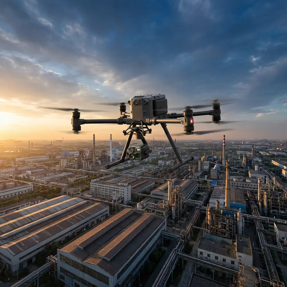
Matrice 4 on Dusty Construction Sites: Flight Altitude, Reliability Habits, and Data Capture That Holds Up
META: Practical Matrice 4 guidance for dusty construction sites, with flight altitude strategy, reliability-minded workflow, thermal and photogrammetry tips, and safer mission planning for repeatable results.
Dust changes everything.
A construction site that looks manageable from the ground can become a difficult environment for a drone the moment rotors start moving air. Fine particulate hangs in the wake, edges disappear in bright sun, and repeated low-altitude passes can ruin both visibility and data quality. If you are planning to use Matrice 4 on active sites, the smartest approach is not simply “fly lower for more detail.” On dusty jobs, that instinct often creates worse results.
The better question is this: what altitude gives Matrice 4 enough visual stability, image consistency, and operational margin to deliver usable outputs without stirring the site into a haze?
That is where disciplined flight design matters.
Why dusty construction sites punish sloppy drone workflows
Dusty environments create a double penalty. First, they interfere with capture quality. Second, they increase the consequences of minor system faults or degraded situational awareness.
This is not just a field observation; it echoes a much deeper engineering principle from aircraft reliability practice. One reference source describes how failure analysis should move beyond identifying a fault mode and into criticality analysis after FMEA is completed. That distinction matters on a jobsite. It is one thing to know a component can fail abnormally. It is another to understand what that failure does during a mission phase, what function is lost, and whether a compensating action exists.
For drone operators, this translates into a simple rule: on dusty construction work, every flight plan should assume that small disruptions cascade faster than usual. A temporary visual obstruction, a poor sensor reading, or a brief control anomaly can have outsized impact when the aircraft is operating close to structures, cranes, stockpiles, or moving machinery.
One of the cited engineering examples analyzes a valve fault rate at 4.8 × 10^-5 and then distinguishes between fault modes by severity class. Even though that example comes from crewed aircraft systems, the operational lesson is directly useful for Matrice 4 crews: not every fault has the same consequence, and dusty sites increase the odds that a normally manageable issue becomes mission-disruptive. That is why your altitude decision is not just about image resolution. It is a reliability decision.
The altitude sweet spot for Matrice 4 in dusty conditions
For active construction delivery, progress monitoring, thermal review, and quick site intelligence, my default recommendation is to begin testing Matrice 4 at 45 to 65 meters AGL rather than dropping immediately to very low inspection height.
Why that range works:
- It reduces rotor wash interaction with loose dust compared with low passes.
- It provides a cleaner observation angle for stockpiles, grading, access roads, and equipment flow.
- It helps preserve consistent overlap for photogrammetry.
- It gives the pilot more time to react if visibility degrades or a crane swing changes the site geometry.
If the mission is orthomosaic capture, I usually treat 50 to 60 meters AGL as the most dependable starting zone on dusty sites, then adjust based on required ground sample distance, lens characteristics, and whether GCPs are being used. If the mission is thermal signature review, a slightly higher hold can often improve interpretation by reducing the effect of heat shimmer and localized dust turbulence around machinery or recently disturbed soil.
Very low flights, especially under 25 to 30 meters, should be used selectively. They are useful for targeted façade checks, roof details, or specific asset documentation. They are a poor default for broad site capture in dusty environments. The aircraft may still perform well, but the data often suffers from inconsistency: drifting dust plumes, softer edges, changing contrast, and reduced image match quality in processing.
The goal is not merely to finish a flight. The goal is to bring back data that can be trusted.
A reliability-first preflight routine for Matrice 4
Construction teams like speed. Drone teams need discipline.
One of the more valuable ideas in the source material is the emphasis on automated fault diagnosis and system reconfiguration in flight control architecture. In the crewed aviation reference, performance degradation thresholds are discussed in extremely small probabilities, such as 1 × 10^-7 per flight hour for certain degraded states. You do not need to import those exact certification-style thresholds into a drone workflow. What you should borrow is the mindset: build operations around early detection, redundancy where possible, and graceful response when something drifts out of limits.
For Matrice 4 on dusty sites, that means your preflight should focus on the things most likely to erode mission quality before they create a visible failure.
Preflight items that matter more in dust than on clean sites
1. Propeller and motor cleanliness
Dust accumulation changes balance over time. Even minor contamination can show up as vibration, which then affects sharpness and mapping consistency.
2. Gimbal freedom and lens inspection
A barely visible film on the lens can flatten contrast across an entire survey. Dust also loves to collect around gimbal interfaces.
3. Battery handling and hot-swap discipline
If your workflow depends on hot-swap batteries to maintain site momentum, treat each swap as a mini-inspection point. Check contacts, seating, and external dust before relaunch. Fast turnarounds are useful only if they do not import reliability risk.
4. Sensor confidence before takeoff
GNSS quality, compass status, visual positioning behavior, and return-to-home logic should all be confirmed before the aircraft leaves a clean launch area.
5. Transmission margin
On complex sites with steel, concrete, containers, and temporary structures, O3 transmission performance should be treated as a planning input, not an assumption. Stand where line-of-sight is realistic for the highest-risk leg of the route.
How to plan a Matrice 4 construction mission that survives dust
There are two very different mission types on most sites: mapping and decision support.
1. Mapping and photogrammetry
If the deliverable is an orthomosaic, 3D model, or volumetric measurement, consistency beats aggressiveness.
A solid workflow looks like this:
- Launch from a clean, stable edge of the site.
- Fly the first mapping grid at about 55 meters AGL.
- Use sufficient frontlap and sidelap to protect reconstruction quality if a few frames are degraded by drifting dust.
- Place and verify GCPs where precision matters, especially if the model will support cut/fill review, progress certification, or subcontractor coordination.
- Avoid flying immediately after major vehicle movement or active grading if possible.
This last point is underrated. Dust is not static. A site that is impossible to map cleanly at 2:00 pm may become straightforward at 4:30 pm after haul traffic slows and the air settles.
2. Decision support, thermal review, and rapid visual intelligence
Sometimes the site team does not need a model. They need answers.
That is where Matrice 4 becomes more than a mapping platform. A thermal signature pass can reveal uneven curing behavior, water intrusion zones, overloaded temporary electrical points, or heat anomalies in equipment staging areas. But thermal interpretation on construction sites requires context. Fresh asphalt, sun-baked metal, wet concrete, shaded aggregate, and active machinery all tell very different stories.
In dust, fly your thermal review from a stable altitude first. I prefer a measured scan from 50 to 70 meters to identify candidate anomalies, then a second pass lower only where clarification is needed. This protects situational awareness and reduces unnecessary time spent hovering in dirty air.
Why fault-tolerant thinking improves ordinary drone operations
The second reference source discusses fault-tolerant computer design in aviation, including automation, redundancy management, maintenance support, and multi-rate processing, with some control computations occurring at 100 Hz or faster. Again, a Matrice 4 is not a transport-category airliner. But the engineering habit behind that architecture is exactly what professional drone operations need: do not rely on one cue, one sensor, or one moment of pilot attention.
On a construction site, fault-tolerant thinking becomes practical in three ways.
Layer 1: Cross-check your data sources
Do not trust only the live view. Compare visible imagery, thermal signature, map previews, telemetry stability, and site conditions. If one input looks wrong, pause and verify.
Layer 2: Build simple recovery options
Predefine alternate hover points, cleaner return paths, and an adjusted mission altitude if dust begins to rise. In other words, use reconfiguration as an operating habit, not just a machine feature.
Layer 3: Make maintenance visible
The reference text highlights maintenance support such as fault logs and testing. That should shape how you manage Matrice 4 fleets. Keep battery cycle history, note recurring transmission weak spots, track lens cleaning frequency, and log any gimbal or positioning irregularities tied to specific sites.
Professionals often think of reliability as a workshop concern. On dusty projects, reliability starts in mission design.
A practical altitude matrix for common construction tasks
Here is the field logic I use most often with Matrice 4:
Progress photography
45 to 60 meters AGL
High enough to avoid stirring excessive dust, low enough to preserve context on work zones and material staging.
Orthomosaic and photogrammetry
50 to 60 meters AGL to start
Raise or lower only after checking overlap quality, wind, and required site detail. Use GCPs when precision is tied to payment, engineering review, or stakeholder reporting.
Thermal overview
50 to 70 meters AGL
Use the first pass to identify abnormal heat patterns, then descend for verification if needed.
Targeted asset inspection
20 to 35 meters AGL, sometimes lower if conditions are calm
Use sparingly on dusty days. Low passes are where visibility degrades fastest.
Roofline, façade, and edge-condition review
Start higher than you think
Dust can roll upward along structures. A slightly standoff capture angle is often cleaner than an aggressively close approach.
Data security and client confidence still matter on site
Construction stakeholders are becoming more sensitive about who sees what. Site maps, progress images, utility layouts, and thermal captures can reveal schedules, methods, and commercial relationships. If you are moving deliverables between field teams and office staff, secure workflows matter. When clients ask how imagery is protected, it helps to explain your process in clear terms, including encrypted handling where supported and disciplined transfer methods rather than ad hoc sharing.
That applies whether the mission is a quick visual check or a recurring BVLOS-style corridor workflow inside a large development footprint with strong procedural controls.
If you want to compare mission patterns for your own site layout, message our field team here: send a site sketch and flight objective.
The hidden reason many construction drone flights underperform
It is usually not the aircraft.
It is the mismatch between mission altitude and environmental reality.
Operators see a dusty site and still fly as if they are documenting a clean solar farm or a quiet roof inspection. Then they wonder why tie points weaken, why thermal interpretation gets messy, or why repeated low passes feel uncomfortable even when the drone itself is behaving normally.
Matrice 4 can be a superb platform for construction work, but it rewards operators who think like system engineers, not tourists. The references behind this article point in that direction. One focuses on fault mode and criticality analysis after FMEA. The other emphasizes automated diagnostics, redundancy management, and strict tolerance for degraded performance. Together, they suggest a clear operating philosophy for drone crews:
- anticipate failure consequences, not just failures;
- preserve margin before conditions deteriorate;
- and design flights so that one compromised input does not ruin the mission.
That is why altitude is such a consequential choice on dusty projects. It is your easiest reliability control.
My recommended starting workflow for Matrice 4 on a dusty build site
If I were deploying Matrice 4 tomorrow for a typical active construction environment, this is the sequence I would use:
- Walk the site perimeter and identify the cleanest launch point.
- Note active haul roads, stockpiles, cranes, and likely dust generation windows.
- Start the first capture at 55 meters AGL.
- Review image clarity and air stability after the first leg, not after the whole mission.
- If mapping, verify that overlap and GCP visibility are holding up.
- If thermal, use the first pass only to locate anomalies.
- Descend for selective close work only after broad coverage is secured.
- Use each hot-swap battery cycle as a deliberate inspection moment.
- Log any recurring visibility, transmission, or sensor-confidence issues tied to that site.
- Standardize that playbook for the next visit so progress data remains comparable over time.
Consistency is what makes drone data useful in construction. A single dramatic flight does less for a project than ten repeatable, disciplined missions that can be compared week after week.
Dusty jobsites reward restraint. Fly a little higher, think a little deeper, and let reliability shape the mission before the aircraft ever lifts off.
Ready for your own Matrice 4? Contact our team for expert consultation.