Matrice 4 in Mountain Vineyards: A Practical Delivery
Matrice 4 in Mountain Vineyards: A Practical Delivery Workflow That Respects Terrain, Signal, and Time
META: A specialist look at using Matrice 4 for mountain vineyard delivery, with practical insight on O3 transmission, antenna adjustment under electromagnetic interference, hot-swap battery planning, AES-256 security, thermal signature checks, and photogrammetry-supported routing.
Mountain vineyards create a strange kind of logistics problem. Distances may look short on a map, yet elevation shifts, narrow access roads, tree lines, rock faces, and unstable signal conditions can turn a simple resupply job into a slow ground operation. When the task is moving small but time-sensitive items between terraces, field crews, storage points, and processing areas, the aircraft matters less than the workflow built around it.
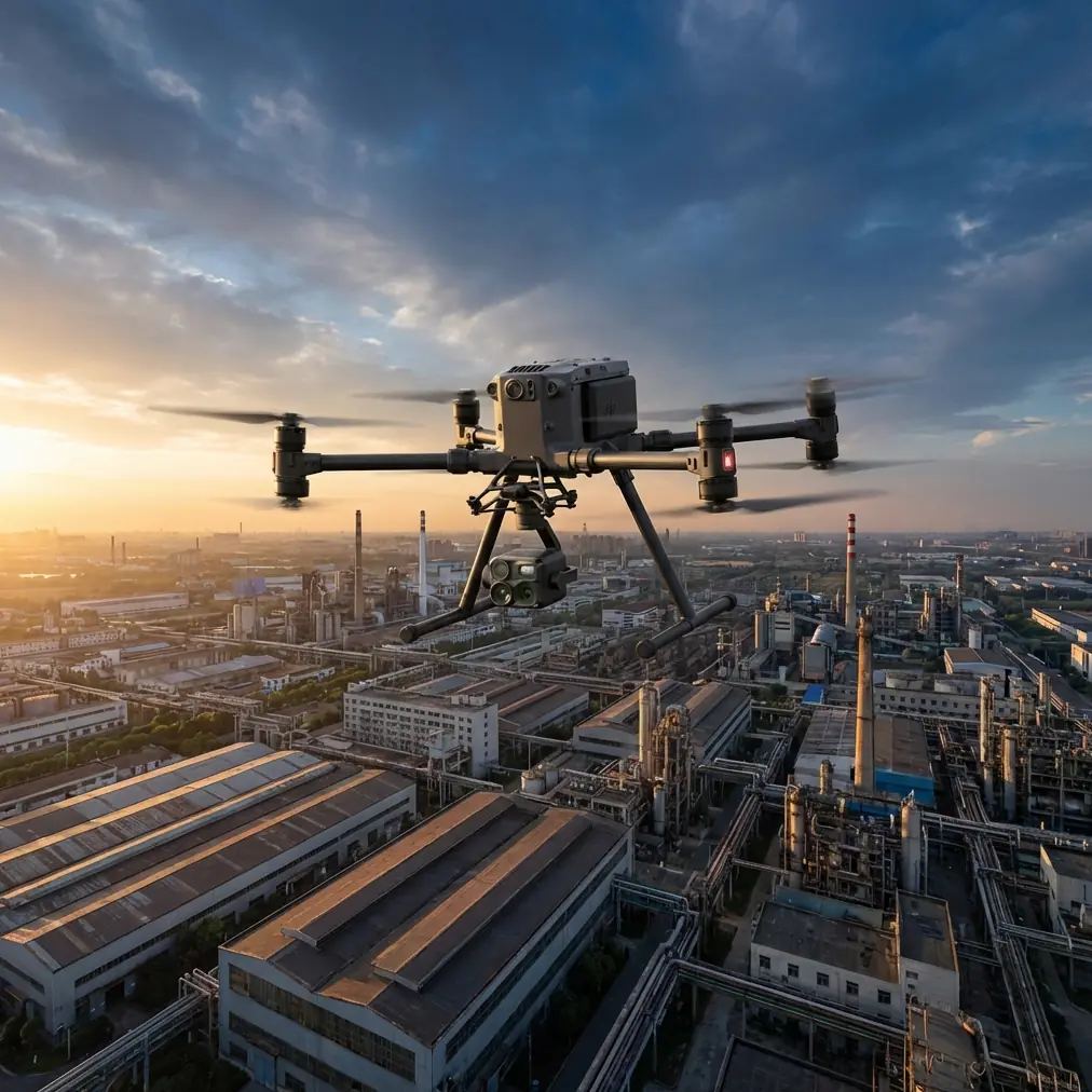
That is where the Matrice 4 becomes interesting.
Not because it magically erases mountain risk. It does not. Its value shows up when you design operations around the realities of altitude, oblique terrain, and broken line-of-sight. For vineyard teams working across slopes, the better question is not “Can this drone fly in the mountains?” The sharper question is “Can this platform maintain a stable, repeatable delivery routine when the environment keeps interfering with navigation, transmission, and turnaround time?”
For that, the Matrice 4 fits a very specific kind of civilian mission profile: short-range delivery support between vineyard zones, route verification over complex ground, and pre-flight terrain assessment using imaging data that reduces guesswork before the payload ever leaves the ground.
The real problem in mountain vineyards is not only distance
Operators new to this environment often focus on payload and endurance first. Those matter, of course, but they are rarely the first thing that breaks a vineyard delivery plan.
The first failure point is usually terrain-driven uncertainty.
A mountain vineyard is full of signal blockers and visual deception. A route that appears open from one launch point may be partially shielded by ridgelines or rows of high-growth vegetation. A downhill leg can feel easy until the return path demands more power against wind and elevation. Add irrigation equipment, utility infrastructure, metal sheds, and repeater installations, and now you have a second issue: electromagnetic interference that can degrade the quality of your control and video link at the exact moment you need precision.
This is why transmission resilience matters so much. In practical field work, O3 transmission is not just a spec-sheet talking point. In mountainous vineyards, it becomes an operational buffer. A stronger transmission system gives pilots more flexibility in route positioning, observation angle, and timing during handoff or drop-zone approach. Even when you remain conservative about range and maintain strict procedural margins, stable transmission reduces hesitation. That means fewer unnecessary holds, fewer route resets, and less time hovering in awkward airspace over sloped ground.
A vineyard manager usually does not care what the transmission protocol is called. They care that the aircraft reaches Terrace C, confirms the landing or release area, and returns without wasting ten minutes fighting link quality. O3 matters because it improves that outcome.
Why mapping comes before delivery
If the mountain vineyard has never been properly modeled, the delivery operation begins with incomplete terrain understanding. That is a mistake.
Before regular delivery flights start, a photogrammetry pass can build the foundation for everything that follows. This is where the Matrice 4 becomes more than a transport tool. By capturing overlapping imagery across the vineyard and tying the data to GCPs, teams can produce a terrain model with enough reliability to identify safe approach corridors, obstacle clusters, slope transitions, and practical staging points.
GCPs are not paperwork theater. They are what help turn a pretty model into an operational surface you can trust. In mountain conditions, a few meters of positional ambiguity can mean the difference between a clean approach path and an aircraft that descends into a visually confusing pocket near vines, netting, or retaining structures. When the site has terraces cut into the hillside, retaining walls, and mixed vegetation heights, that accuracy becomes operationally meaningful very quickly.
Photogrammetry also changes how teams think about delivery scheduling. Once you have a current model, you stop improvising every route from live camera view alone. You can pre-identify the least disruptive corridor, estimate expected flight profiles between elevation bands, and choose handoff points where people do not need to stand in unstable or exposed positions.
That is a better use of the Matrice 4 than treating it as a flying shortcut.
Thermal signature is not just for search tasks
One of the more practical uses of thermal signature assessment in a vineyard delivery workflow has nothing to do with dramatic scenarios. It is about environmental verification and equipment awareness.
Early morning mountain flights can create misleading visual conditions. Cold pockets settle unevenly. Moisture lingers in shaded rows. Roof surfaces, rocks, metal fixtures, and parked machinery may heat or cool differently than the surrounding ground. A thermal check can help crews verify that the intended landing or transfer zone is clear of recently active equipment, people, or animals before committing to a low approach. It can also help spot heat-emitting infrastructure that may not be obvious in visual imagery alone.
That matters in vineyards because delivery points are rarely sterile pads. They are often improvised work areas near pumps, small tractors, utility cabinets, or storage bins. A quick thermal review adds context that a standard RGB pass may miss.
There is another benefit. Thermal signature patterns can help teams understand localized microclimate differences across the mountain. That may not seem directly connected to delivery, but it affects where crews are working, when supplies are needed, and which terrace zones are most difficult to service by vehicle after moisture or temperature swings. A drone workflow that combines logistics support with environmental observation is much easier to justify operationally than a single-purpose flight program.
Handling electromagnetic interference: antenna discipline matters
This is one of those subjects that sounds minor until you watch an otherwise routine mission become unstable.
In mountain vineyards, electromagnetic interference often comes from a mix of infrastructure rather than one obvious source. Utility lines, pump systems, communications equipment, Wi-Fi spillover from nearby buildings, metal structures, and even the terrain itself can create inconsistent link behavior. The effect may show up as fluctuating signal quality, delayed video response, or uneven control confidence in particular sections of the route.
A lot of operators react too late. They see degraded signal and assume the aircraft needs to push through or climb immediately. Sometimes the smarter answer starts at the controller.
Antenna adjustment is not a ceremonial step. It is active link management. With O3 transmission, maintaining proper antenna orientation relative to the aircraft can make the difference between a stable segment and a noisy one, especially when the route bends around a hillside. In practice, the pilot should avoid pointing the antenna tips directly at the aircraft and instead orient them to present the strongest effective face toward the expected flight path. As the Matrice 4 moves laterally along a terrace line or disappears partially behind slope geometry, small controller adjustments can recover cleaner transmission without overcorrecting the aircraft itself.
This matters because not all interference is constant. Some vineyard sectors may behave well on one pass and degrade on another due to machinery operation, crew movement, or atmospheric conditions. Skilled antenna management gives the pilot one more layer of control before deciding to alter altitude, reposition the ground station, or suspend the mission.
If your team is building a mountain delivery protocol and wants a field-oriented checklist for interference handling, it often helps to discuss route design and controller positioning before the first live operation through this direct planning channel.
Battery workflow decides whether the operation scales
Mountain delivery is rarely defeated by a single long mission. It is defeated by repeated short missions with poor turnaround planning.
This is why hot-swap batteries deserve more attention than they usually get. In a vineyard environment, flight windows are often dictated by crew timing, weather openings, or processing deadlines. If the aircraft returns and then sits idle while batteries cool, charge, or get replaced through a slow procedure, the entire system loses its edge.
Hot-swap capability changes the rhythm. It allows the team to maintain aircraft readiness between consecutive support flights, which is especially useful when supplies must be moved in sequence to different elevations during harvesting, maintenance, or disease-treatment support operations. Even if each leg is modest, the cumulative value comes from reducing ground delay.
There is a second operational advantage. In mountain terrain, pilots should keep battery margins conservative because return conditions can worsen unexpectedly. Wind channels along slopes and ridgelines do not always behave the same way both directions. A workflow built around quick battery exchange makes it easier to preserve those margins without sacrificing schedule. Instead of stretching one flight profile too aggressively, the team can split tasks into cleaner segments and relaunch quickly.
That is how a drone program matures: not by heroic single sorties, but by disciplined repetition.
Security matters when routes and crop operations are sensitive
Vineyards may not look like high-security environments, yet the data involved can be commercially sensitive. Terrain models, infrastructure locations, logistics routines, crop-condition imagery, and movement patterns all have value. If a team is using the Matrice 4 for photogrammetry, thermal observation, and delivery support, they are building a detailed operational picture of the property.
AES-256 matters here because secure transmission and data handling are not abstract enterprise features. They help protect site information during flights and support stronger governance when multiple crews, consultants, or managers rely on the same operational dataset.
For larger vineyard operators or regional cooperatives, this becomes even more relevant when planning BVLOS development pathways in the future. Even if current operations remain conservative and within standard visual supervision frameworks, teams often design with expansion in mind. Secure communications, disciplined mapping, and documented route logic are all part of building toward more advanced workflows without having to restart from scratch later.
BVLOS is not something to treat casually in mountain environments. It requires regulatory compliance, site analysis, and a safety case that reflects terrain and connectivity realities. But from a planning standpoint, the Matrice 4 workflow becomes stronger when today’s flights are organized as if they will eventually need that level of procedural maturity.
A practical problem-solution model for vineyard delivery
If I were advising a mountain vineyard team from the ground up, I would frame the Matrice 4 operation like this:
Problem: ground transport between terraces is slow, intermittent, and labor-intensive.
Solution: use the aircraft as part of a structured logistics network, not as a replacement for all movement.
First, map the site using photogrammetry with GCP support. Establish trusted terrain intelligence.
Second, identify high-frequency transfer needs: tools, samples, small treatment materials, sensor replacements, documentation packets, or maintenance components.
Third, define route segments that preserve communication strength rather than merely following the shortest straight line.
Fourth, create launch and reception points informed by both visual and thermal signature checks, especially in morning and late-day conditions.
Fifth, train pilots in antenna adjustment and interference recognition, because mountain transmission problems are often solved through positioning and discipline rather than brute-force flying.
Sixth, design battery rotation around hot-swap tempo so the aircraft supports operations continuously during peak demand periods.
This is a more durable model than asking the Matrice 4 to be an all-purpose miracle machine. In vineyards, success usually comes from reducing friction at the margins: shaving transport time, preventing unnecessary climbs by workers, improving responsiveness between terraces, and making data collection serve the delivery mission instead of competing with it.
What makes the Matrice 4 especially useful here
The most convincing case for the Matrice 4 in mountain vineyards is not a single headline feature. It is the way several capabilities reinforce each other.
O3 transmission supports route stability where terrain and infrastructure can disrupt communication.
Hot-swap batteries support tempo, which is often more valuable than chasing maximum endurance on paper.
Photogrammetry with GCP-backed accuracy turns a difficult hillside into a known operating environment.
Thermal signature checks improve landing-zone awareness and add context to daily field conditions.
AES-256 supports responsible handling of imagery, route data, and operational intelligence.
Taken together, these details shift the drone from a gadget to a system.
For vineyard teams working in the mountains, that distinction is everything. The aircraft has to do more than fly. It has to fit the rhythms of agriculture, tolerate imperfect signal conditions, respect terrain, and deliver repeatable results for crews who are busy with vines, timing, and weather—not aviation theory.
That is the lens through which the Matrice 4 makes sense.
Ready for your own Matrice 4? Contact our team for expert consultation.