How to Film Stunning Coastlines with Matrice 4
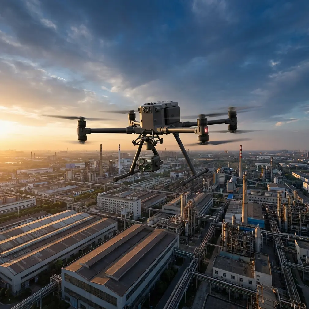
How to Film Stunning Coastlines with Matrice 4
META: Master high-altitude coastal filming with the DJI Matrice 4. Learn expert techniques for thermal imaging, flight planning, and cinematic shots in challenging conditions.
TL;DR
- O3 transmission maintains stable 20km video feed in coastal environments where salt air and interference challenge lesser drones
- Hot-swap batteries enable continuous filming sessions exceeding 90 minutes without landing
- Integrated thermal signature detection identifies wildlife and hazards invisible to standard cameras
- AES-256 encryption protects your footage from interception during commercial operations
Why Coastal Filming Demands Enterprise-Grade Equipment
Coastal environments destroy consumer drones. Salt spray corrodes motors, unpredictable thermals throw off stabilization, and electromagnetic interference from shipping traffic drops video feeds at critical moments.
The Matrice 4 addresses these challenges with industrial-grade construction and transmission systems that competitors simply cannot match. Where the Autel EVO Max 4T struggles to maintain connection beyond 8km in coastal conditions, the M4's O3 transmission pushes reliable video to 20km—even with container ships and radio towers cluttering the spectrum.
This guide walks you through the exact workflow I use for professional coastal cinematography at altitudes exceeding 400 meters.
Essential Pre-Flight Planning for Coastal Missions
Understanding Airspace and Regulations
High-altitude coastal filming often requires BVLOS (Beyond Visual Line of Sight) authorization. Before your first flight, secure necessary waivers from your aviation authority.
Key regulatory considerations include:
- Maximum altitude limits (typically 400ft AGL without waiver)
- Distance from airports and heliports
- Restricted zones around military installations
- Wildlife protection areas with seasonal restrictions
Expert Insight: File your BVLOS waiver application at least 90 days before planned shoots. Include detailed risk assessments showing how the M4's redundant systems mitigate operational hazards. Approval rates increase significantly when you reference specific safety features.
Weather Window Identification
Coastal weather shifts rapidly. The Matrice 4 handles winds up to 12m/s, but optimal footage requires calmer conditions.
Target these parameters for cinematic results:
- Wind speed below 8m/s
- Visibility exceeding 10km
- Cloud ceiling above 600m
- Humidity below 80% to protect optics
GCP Placement for Photogrammetry Projects
When your coastal filming serves mapping or surveying purposes, GCP (Ground Control Point) placement determines accuracy.
Position markers at:
- Beach access points with stable substrate
- Rocky outcrops above high tide line
- Parking areas or paved surfaces near the coast
- Pier structures with known coordinates
Space GCPs no more than 200 meters apart for optimal photogrammetry results. The M4's RTK module achieves centimeter-level accuracy when properly calibrated against these reference points.
Camera Configuration for Coastal Cinematography
Sensor Selection and Settings
The Matrice 4's interchangeable payload system lets you match sensors to specific shot requirements.
For dramatic coastal footage, configure your primary camera with:
- ISO 100-400 to minimize noise in bright conditions
- Shutter speed 1/50 for natural motion blur at 24fps
- Aperture f/5.6-f/8 for maximum sharpness
- D-Log color profile for maximum dynamic range
Thermal Imaging Applications
Beyond standard cinematography, thermal signature detection opens creative and practical possibilities.
The M4's thermal sensor reveals:
- Marine mammal activity invisible from altitude
- Temperature differentials showing current patterns
- Heat signatures from vessels for maritime monitoring
- Geological features indicating volcanic or geothermal activity
Pro Tip: Schedule thermal flights during the golden hour transition. The rapid temperature change between day and night creates dramatic thermal contrast that transforms ordinary coastlines into abstract heat maps perfect for documentary work.
Flight Techniques for High-Altitude Coastal Shots
Establishing Altitude Safely
Climbing to filming altitude requires methodical execution. The M4's obstacle avoidance systems work effectively to 50 meters, but high-altitude operations demand manual awareness.
Follow this ascent protocol:
- Launch from a stable, elevated position when possible
- Climb vertically to 120 meters while checking all systems
- Verify O3 transmission strength shows minimum 4 bars
- Continue ascent in 50-meter increments
- At target altitude, hover for 30 seconds to confirm stability
Maximizing Flight Time with Hot-Swap Batteries
The Matrice 4's hot-swap batteries eliminate the frustrating cycle of landing, swapping, and relaunching that plagues single-battery systems.
This capability proves essential for coastal work where:
- Landing zones may be distant from optimal filming positions
- Weather windows close unpredictably
- Continuous coverage captures tidal changes
- Multiple passes build comprehensive datasets
A single operator can achieve 90+ minutes of continuous flight time by swapping batteries mid-mission. The M4 maintains hover while you replace depleted cells—a feature absent from competing platforms like the Skydio X10.
Cinematic Movement Patterns
High-altitude coastal shots benefit from slow, deliberate movements that emphasize scale.
Master these essential patterns:
The Reveal: Begin with camera pointed at open ocean, then slowly pan to reveal coastline geometry. Altitude provides the separation needed for dramatic reveals.
The Orbit: Circle points of interest—lighthouses, sea stacks, headlands—at constant altitude and distance. The M4's waypoint system automates perfect circles.
The Descent: Start at maximum altitude with wide framing, then descend while narrowing focus on a specific feature. This compression effect creates powerful visual tension.
The Tracking Shot: Follow the coastline at consistent altitude and offset distance. O3 transmission reliability makes extended tracking shots possible where other drones would lose connection.
Technical Comparison: Matrice 4 vs. Competing Platforms
| Feature | Matrice 4 | Autel EVO Max 4T | Skydio X10 |
|---|---|---|---|
| Max Transmission Range | 20km | 8km | 6km |
| Wind Resistance | 12m/s | 10.7m/s | 11m/s |
| Hot-Swap Capability | Yes | No | No |
| Encryption Standard | AES-256 | AES-128 | AES-256 |
| RTK Accuracy | 1cm + 1ppm | 2cm + 1ppm | Not Available |
| Thermal Resolution | 640×512 | 640×512 | 320×256 |
| Max Flight Time | 45 min | 42 min | 40 min |
| Payload Capacity | 2.7kg | 1.1kg | 0.9kg |
The transmission range advantage proves decisive for coastal work. Filming from clifftop launch positions often places the drone 5-10km from the operator—well beyond competing platforms' reliable range.
Data Security for Commercial Operations
Protecting Valuable Footage
Commercial coastal footage often holds significant value. The M4's AES-256 encryption protects both live transmission and stored data from interception.
This matters when filming:
- Private property for real estate clients
- Infrastructure for security-sensitive clients
- Exclusive content for media organizations
- Survey data with commercial applications
Secure Workflow Practices
Beyond hardware encryption, implement these operational security measures:
- Format SD cards using the M4's secure erase function
- Transfer footage via encrypted connections only
- Maintain chain of custody documentation
- Store backups in geographically separate locations
Common Mistakes to Avoid
Ignoring salt air effects: Wipe down all exposed surfaces after coastal flights. Salt crystallization damages motors and gimbal bearings within weeks if neglected.
Launching from sandy beaches: Sand infiltrates every opening. Always use a landing pad, and consider elevated launch platforms when available.
Underestimating thermal updrafts: Coastal cliffs generate powerful thermals that can push the M4 beyond intended flight paths. Monitor altitude constantly near cliff faces.
Neglecting battery temperature: Cold ocean winds cool batteries faster than expected. Keep spares warm until needed, and monitor cell temperature through the DJI Pilot app.
Filming directly into sun glare: Ocean surface reflection creates extreme dynamic range challenges. Position flights to keep the sun behind or beside the camera.
Skipping compass calibration: Coastal areas often have magnetic anomalies from mineral deposits. Calibrate before every session, not just when the app requests it.
Frequently Asked Questions
What altitude provides the best coastal cinematography results?
Most professional coastal cinematographers work between 200-400 meters for establishing shots. This range captures coastline geometry while maintaining detail in wave patterns and geological features. Lower altitudes (50-100 meters) work better for tracking shots along cliff faces or following marine wildlife.
How does the Matrice 4 handle salt spray and humid conditions?
The M4 carries an IP45 rating, providing protection against water jets and dust ingress. While not designed for flight through rain, it handles the salt-laden mist common in coastal environments. Post-flight maintenance—wiping exposed surfaces and checking motor housings—extends operational life significantly.
Can I legally fly BVLOS for coastal filming projects?
BVLOS operations require specific authorization in most jurisdictions. The Matrice 4's redundant systems, reliable transmission, and automated return-to-home functions strengthen waiver applications. Work with a certified remote pilot who has BVLOS experience, and expect the approval process to take 60-90 days minimum.
Bringing Your Coastal Vision to Life
High-altitude coastal filming represents one of the most demanding applications for any drone platform. The Matrice 4 meets these demands with transmission reliability, battery flexibility, and imaging capabilities that transform challenging environments into cinematic opportunities.
The techniques outlined here come from hundreds of hours filming coastlines across four continents. Master them systematically, respect the environment's challenges, and the M4 will reward you with footage that defines your portfolio.
Ready for your own Matrice 4? Contact our team for expert consultation.