How I’d Use Matrice 4 to Film Mountain Coastlines Without Lo
How I’d Use Matrice 4 to Film Mountain Coastlines Without Losing Control, Data Quality, or Nerve
META: A field-focused Matrice 4 tutorial for filming rugged coastlines in mountain terrain, covering signal stability, flight control strategy, sampling precision, electromagnetic interference, and practical capture planning.
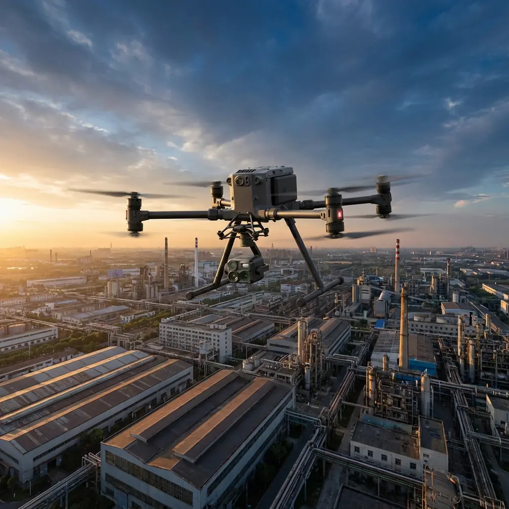
Filming a coastline that runs beneath steep mountain walls looks simple from the road. Put a drone up, follow the edge, collect the hero shots. In practice, this is one of the messiest environments you can hand to a UAV crew.
You have salt haze, gusts curling off ridgelines, changing light, reflective water, dark rock, and one more problem people often underestimate: signal behavior in terrain. Mountain faces and coastal infrastructure can create multipath reflections and local electromagnetic noise that make a pilot doubt the link long before the aircraft is actually in trouble.
If I were preparing a Matrice 4 for this job, I would not start with camera settings. I would start with control logic, mission authority, and data confidence. That sounds abstract until you are halfway through a shoreline run, the aircraft rounds a rocky shoulder, and your downlink starts to wobble.
The useful lesson comes from two very different technical references. One is about UAV flight control and management. The other is about extracting the true peak from a fast decaying sinusoidal signal using interpolation. On paper, these topics live in separate worlds. In real flight operations, they meet at the exact point where a crew decides whether the information on screen is trustworthy enough to continue the mission.
The real challenge in mountain coastline filming
A mountain coastline compresses several flight risks into one corridor. The route is visually linear, but operationally it is broken into pockets. Every cove, cliff corner, and ridge transition can change wind, GPS quality, and radio behavior.
That matters because a good Matrice 4 sortie in this setting is not just about getting cinematic footage. It is about maintaining clean control authority while collecting consistent visual and, if required, thermal signature data that remains usable later for inspection, environmental documentation, or photogrammetry.
This is where a disciplined flight-control mindset matters more than bravado. A 2008 paper from Beihang’s UAV research institute framed unmanned systems progression clearly: the industry moved from primarily remote-piloted vehicles to UAVs with some autonomous capability, and then to broader unmanned aircraft systems where support systems matter as much as the aircraft itself. That framing still holds. For a Matrice 4 coastline mission, the aircraft is only one element. The transmission link, mission planning logic, pilot intervention rules, onboard management, and post-flight data validation are equally important.
In plain terms: if your crew treats the flight as “manual flying with a nice camera,” they are leaving too much to luck.
Why antenna adjustment matters more than people admit
The prompt here mentions handling electromagnetic interference with antenna adjustment, and that is exactly the right place to get practical.
Along mountain coastlines, interference is not always classic “EMI” from a big obvious source. Sometimes the issue is a combination of reflected transmission paths, partial masking by terrain, vessels using radio equipment offshore, or utility installations near cliff roads. With O3 transmission, the Matrice 4 platform can maintain strong situational awareness, but only if the ground side is managed properly.
When I see intermittent link quality in this environment, my first response is not to overcorrect with aggressive stick inputs. I look at the geometry.
Antenna adjustment should be deliberate:
- keep the controller oriented so the antenna pattern faces the aircraft rather than pointing the antenna tips directly at it
- reposition the pilot a few meters if a rock wall or parked vehicle is creating a local reflection problem
- avoid standing beside metal railings or infrastructure cabinets when possible
- climb or offset laterally before rounding a ridge that may shadow the link
- if the route pushes behind a headland, break the mission into segments rather than trying to bully through one continuous line
This sounds basic, but it connects directly to the broader UAV control-and-management principle from the Beihang paper: control modes and authority should be matched to the operating situation. The paper distinguishes remote control, human-intervened automatic control, and autonomous control as different modes with different suitable conditions. That is not academic language. On a mountain coastline shoot, it becomes a rule.
If signal behavior is clean and terrain visibility is predictable, human-supervised automated pathing can improve consistency. If the route enters a signal-compromised pocket, manual intervention needs to be immediate and pre-planned. The skilled crew is not the one that insists on a single mode. It is the one that changes mode before the aircraft forces the issue.
The hidden value of “true peak” thinking
Now to the second reference, which seems unrelated until you think like an operator.
The signal-processing paper describes a method for finding the true extreme point of a rapidly decaying sinusoidal signal. Instead of trusting a sampled local maximum directly, it takes four points around the candidate peak and uses Newton cubic interpolation to estimate the real maximum more accurately. In the example method, the points are normalized in sequence as 0, 1, 2, and 3 with a sampling interval Δt, and the derivative is then solved to identify the actual extremum between sampled points.
Why should a Matrice 4 crew care?
Because what you see in the field is often a sampled version of reality. A coastline wave impact, a thermal contrast along wet rock, a gust response in the aircraft attitude trace, or a brief transmission dip on the monitor can all be misleading if judged from one obvious peak or one ugly frame.
Operationally, this means two things.
First, don’t overreact to a single telemetry spike or a single ugly image preview. A sampled point can exaggerate or understate what is truly happening. This is especially relevant when reviewing gimbal stability, wind disturbance, or thermal signature contrast in high-variability scenes.
Second, build capture plans that create enough temporal and spatial redundancy to reveal the true condition later. If you are documenting erosion, vegetation stress, seepage, or structural defects on coastal paths, one pass is rarely enough. Slightly overlapping passes, repeated angle checks, and controlled speed produce data that can be interpreted with more confidence, much like using interpolation to estimate the real peak instead of trusting the nearest sample.
That reference contains a concrete and useful detail: the method uses four neighboring points and then solves the derivative of the cubic to locate the actual maximum. For drone work, the lesson is not to imitate the math in the field. The lesson is to respect sub-frame reality. Fast-changing scenes need dense enough capture to avoid false conclusions.
A practical Matrice 4 workflow for mountain coastline filming
Here is how I would structure the job.
1) Split the coastline into control zones
Do not define the mission as one long scenic route. Divide it into short sections based on terrain shielding, expected wind exposure, and likely signal visibility. A cove under a cliff should be one zone. An open headland should be another. A harbor approach with infrastructure nearby should be its own zone.
This supports safer control transitions and cleaner battery planning. If you are using hot-swap batteries in a multi-sortie schedule, these short zones help you preserve continuity without stretching a single flight past the point where judgment gets lazy.
2) Decide what the mission output actually is
“Film the coastline” is not a deliverable.
Is the result meant for cinematic editing, orthomosaic generation, slope-condition review, habitat documentation, or thermal anomaly screening? If photogrammetry is involved, I would immediately shift the route design away from cinematic instincts and toward repeatable overlap, stable altitude references, and GCP integration where accessible and safe.
In mountain coastal terrain, GCP placement is often partial rather than uniform. That is fine. You do not need to force textbook distribution if access is limited by cliffs or tide windows. What matters is using visible, stable control where it can materially reduce distortion in the critical sections. Steep relief and water edges are exactly where weak control tends to show up in the final model.
3) Start high, then descend only with a purpose
A high reconnaissance pass tells you where the signal weakens, where rotor wash may interact with cliff faces, and where visual composition improves or collapses.
For cinematic work, pilots often descend too early because the foreground looks dramatic. I prefer to earn that descent with information. Once you know where the safe lanes are, you can move lower for parallax-rich passes without wondering whether the next rock shoulder will interfere with the link.
4) Use autonomy carefully, not romantically
The Beihang reference highlights not only flight control but mission management, fault judgment, telemetry management, and equipment management. That is the right mental model for Matrice 4 operations.
Automated legs are excellent for repeatability. They help maintain speed, heading discipline, and capture consistency. But in terrain with abrupt RF behavior, autonomy should be supervised as a management tool, not worshipped as a guarantee. Set routes that leave room for interruption. Know where you can pause, climb, yaw, or retreat cleanly if the transmission quality drops.
This is also where AES-256-secured workflows matter for commercial teams handling sensitive survey or infrastructure media. Security does not improve composition, but it does matter when you are moving project data through client review pipelines or remote operations teams.
5) Read thermal carefully near water and rock transitions
If your Matrice 4 payload configuration includes thermal, coastlines are full of false stories. Wet surfaces, sun-warmed rock, shaded cavities, and evaporative cooling can create thermal signature differences that look meaningful and are sometimes not.
Again, the interpolation paper offers a useful mindset. The obvious hotspot or cold patch in one moment may not be the true operational extreme. Recheck from a second angle. Compare against visible imagery. If possible, repeat the pass after a short interval. Fast-changing environments punish snap interpretations.
This matters for civilian use cases such as seepage observation, infrastructure checks along coastal trails, or environmental assessments. Reliable thermal interpretation depends on context, not isolated contrast.
Handling electromagnetic interference in the field
Let’s get very specific.
If O3 transmission quality starts fluctuating near a mountainside section:
- Stop lateral progression for a moment.
- Raise altitude modestly if terrain masking is likely.
- Reorient the controller antennas correctly.
- Step away from nearby metal barriers, vehicles, or utility hardware.
- Confirm whether the fluctuation follows heading, position, or altitude.
- If the issue repeats at the same terrain corner, redesign the route rather than forcing a low pass.
Pilots sometimes blame the aircraft when the geometry is the real culprit. In mountain shoreline work, small body-position changes by the operator can noticeably affect link stability. That is not superstition. It is fieldcraft.
If your crew wants a second set of eyes on route segmentation or link strategy before heading out, you can message our flight planning desk here.
Why software and simulation still matter on a “simple” shoot
The 2008 UAV control paper also emphasizes real-time software development and high-fidelity simulation testing as key technologies. That idea ages well.
A coastline mission may look like a lightweight content job, but the smartest crews rehearse it like an engineering task. They preview terrain in 3D maps, identify potential signal shadow points, estimate recovery corridors, and decide in advance which segments are best flown manually versus semi-automatically.
That preparation reduces improvisation under pressure. It also improves the consistency of visual output. Pilots who do this well tend to return with footage that feels intentional rather than merely adventurous.
What separates a usable Matrice 4 mission from a lucky one
Three things.
First, control authority is managed, not assumed. The aircraft may be capable, but terrain always votes.
Second, data is captured densely enough to reflect reality rather than a handful of misleading samples. The signal-processing reference’s four-point interpolation method is a powerful reminder that the nearest visible peak is not always the true one. In drone terms, one frame, one pass, or one telemetry bump should not decide the story.
Third, the mission is treated as a system. Aircraft, pilot, automation, telemetry, antenna orientation, terrain, and post-processing objectives all belong in the same plan. That is exactly the systems view described in the UAV flight control and management literature, and it is the difference between attractive footage and dependable operational output.
Matrice 4 is most effective on mountain coastlines when flown with that discipline. Not because the environment is impossible, but because it is deceptive. The shots are there. So are the traps.
Ready for your own Matrice 4? Contact our team for expert consultation.