How to Film Vineyards in Complex Terrain with Matrice 4
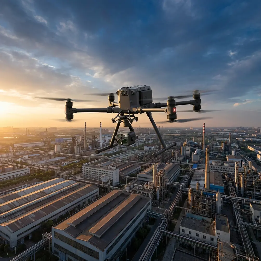
How to Film Vineyards in Complex Terrain with Matrice 4
META: Practical field guide to filming vineyards in steep, uneven terrain with Matrice 4, including antenna positioning, photogrammetry planning, thermal workflow, battery strategy, and reliable transmission tips.
Vineyards are deceptive flight environments. On paper, they look orderly: rows, symmetry, open sky. In the field, especially on broken terrain, they behave more like a stack of micro-landscapes stitched together by slope, wind, vegetation height, reflective leaves, irrigation hardware, and sudden elevation changes. A drone pilot can launch from a tidy access road and, two minutes later, lose visual quality on the live feed because a ridgeline, a tree belt, or even the angle of the rows interferes with the link.
That is where a Matrice 4 workflow needs to be more disciplined than a typical “fly and film” session.
If your objective is to capture vineyards cleanly in complex terrain, the job is rarely just about pretty footage. You may be documenting canopy health, creating cinematic marketing assets for an estate, building terrain-aware photogrammetry outputs for planning, or combining visible and thermal signature data to understand irrigation inconsistencies and vine stress. The aircraft becomes part camera platform, part survey tool, part communications test.
I approach this kind of mission as a layered operation: transmission first, terrain second, sensor strategy third, then battery rhythm and data integrity. If you get those four right, the footage looks better and the mission becomes calmer.
Start with the terrain, not the camera
The most common mistake in vineyard filming is choosing takeoff position based on convenience rather than radio geometry.
Complex vineyard terrain breaks line of sight in subtle ways. A launch point near the estate building may feel central, but if the rows drop sharply into a valley or wrap around a hill shoulder, your aircraft can slip behind terrain before you notice the image getting unstable. By then, small control corrections become less precise and your framing suffers.
With Matrice 4, the transmission side of the mission deserves as much planning as the lens side. If you are working with O3 transmission, your practical goal is not simply “maximum range.” It is maximum signal stability through the exact sector of sky and landform your route will occupy. Range on a specification sheet is one thing; range in a terraced vineyard with elevation changes is another.
Before takeoff, stand at your proposed launch point and ask three questions:
- Can I maintain the cleanest possible line between controller and aircraft through the entire run?
- Will the aircraft ever move behind a ridge, tree wall, winery roofline, or utility structure?
- Does my body position force the controller antennas into a poor orientation as I track the aircraft?
That third point matters more than many operators realize.
Antenna positioning advice for maximum range
If you want the strongest possible link in vineyard terrain, don’t point the antenna tips directly at the drone. That feels intuitive, but it is often wrong. For typical controller antenna geometry, the strongest signal pattern is usually broadside to the aircraft, not off the narrow end of the antenna.
In practice, that means:
- Keep the flat face or side of the antenna array oriented toward the aircraft’s path.
- Avoid angling the controller downward while looking at the screen.
- Rotate your whole body as the aircraft moves rather than twisting only your wrists.
- If the flight path runs along a slope, reposition yourself partway through the mission if needed instead of insisting on one static pilot location.
In vineyards cut across hillsides, one simple adjustment can make a major difference: move uphill for launch whenever safe and practical. Gaining even a modest amount of elevation at the pilot position often reduces the chance that a vine block, berm, or access embankment interrupts the O3 link. The aircraft may be only a few dozen meters above ground, but your radio path can still be partially masked by terrain undulations.
I often tell crews to think of antenna placement as “framing the air corridor.” You are not merely aiming at the drone. You are aligning the transmission lobe with the segment of sky where the drone will spend most of the mission.
If your site is especially awkward and you want a second opinion on flight geometry or controller setup, a quick field planning discussion can save a lot of wasted batteries. This is the sort of issue worth resolving before wheels-up: message a Matrice specialist here.
Build the shot list around terrain transitions
Many vineyard flights fail aesthetically because the operator flies the rows, but ignores transitions between landforms.
Rows are visually satisfying, yes. But in complex terrain, the best material often comes from where one block meets another: a crest line where morning light hits unevenly, a terrace edge where retaining geometry becomes visible, a drainage cut that reveals how the vineyard interacts with the hillside, or a lane where mature windbreaks shape the visual rhythm.
With Matrice 4, plan three categories of passes:
1. Structure passes
These show estate layout, road access, row direction, and elevation logic. Fly higher and slower than you would for purely cinematic work so the viewer can read the vineyard’s organization.
2. Canopy passes
These sit lower and closer, with a route aligned to the vine rows. Here, the challenge is altitude consistency over changing terrain. In steep blocks, a pass that looks smooth at one end can become too high or too low by the midpoint if you are not monitoring ground relief closely.
3. Terrain-reveal passes
These are the money shots in hilly vineyards. Start with vine texture in the foreground, then let the slope, valley, or ridgeline emerge. This is where a professional mission separates itself from generic drone footage.
The key is not to treat the vineyard as flat agricultural land. It is a managed landscape shaped by topography, and your route design should make that visible.
Use photogrammetry to make your filming smarter
Even if your end product is video, photogrammetry can sharpen your planning.
A quick mapping run before the hero shots gives you a terrain reference that helps in three ways. First, it exposes elevation changes that are easy to underestimate from the ground. Second, it helps you design safer repeatable routes through narrow or irregular blocks. Third, it gives your client an operational deliverable beyond footage.
This matters especially in vineyards with variable slopes, fractured parcel boundaries, and mixed canopy density. If you build a surface model and orthomosaic, you can pre-visualize where a low tracking pass will compress nicely, where a rise will interrupt the line, and where shadows will be most severe at a given hour.
If the vineyard team uses GCP markers, that improves geospatial confidence. For a filmmaker, that may sound like survey language. Operationally, it means your map base is more reliable when you plan repeat flights over a season. The same route can be flown again to document growth stage, irrigation effects, replant sections, or erosion development.
That repeatability becomes far more useful than one-off “beautiful drone footage.”
Thermal signature is not just for inspection teams
Thermal work in vineyards is often treated as a separate technical mission, disconnected from filming. That is a missed opportunity.
A thermal signature pass can reveal irrigation anomalies, uneven moisture retention, and temperature differences between blocks that are hard to read in standard visible imagery. For vineyard managers, these patterns can be operationally meaningful. For content teams, they add depth to the story of the site.
The practical significance is simple: if one slope is heating earlier than another, or one section of canopy behaves differently after irrigation, your visible-light filming can be timed and framed around that reality. Instead of shooting generic vineyard texture, you can document a genuine agronomic condition.
Thermal also helps in early morning planning. In complex terrain, cold air pooling and uneven warming can produce strong contrast between lower rows and elevated sections. Capturing both visible and thermal datasets during the same window gives a more complete view of the vineyard as a terrain-dependent system.
For civilian agricultural use, that is where thermal earns its place. Not as a novelty image, but as a way to connect landscape form with vine performance.
Don’t waste batteries solving preventable problems
Battery management in vineyards is not just about endurance. It is about preserving momentum on sites where terrain and travel paths slow everything down.
Hot-swap batteries are particularly valuable when you are filming across dispersed blocks. If your crew is walking between terrace edges, repositioning vehicles, or adjusting launch points to maintain line of sight, every unnecessary shutdown costs time and resets the workflow. Hot-swap capability reduces that friction. You land, change packs, verify status, and continue without turning a compact field stop into a full reconfiguration.
That matters because vineyard light changes quickly. A ridge can cast a block into shadow in minutes. If your battery routine is slow, you miss the window that gave the rows their definition.
My recommendation is to assign batteries to mission roles rather than using them in random rotation:
- One set for mapping and photogrammetry
- One set for low-level cinematic passes
- One reserve set for unplanned re-flights or thermal follow-up
This helps avoid the common mistake of burning your freshest packs on scouting legs and then trying to execute precision low-level work with less margin.
Treat signal security and data handling as part of professionalism
Many vineyard projects involve private estates, proprietary cultivation methods, restricted infrastructure areas, or early-stage marketing content that is not ready for public release. Data security is not abstract here.
If your workflow includes AES-256 protected transmission or file security practices, that has real-world significance. It means the footage and operational data generated on site are better protected while moving through your system. For commercial clients, especially premium wine producers and agricultural managers, that is part of the trust equation.
A professional drone operation is not only judged by image quality. It is judged by how reliably it handles location data, crop imagery, and internal planning materials.
BVLOS language deserves restraint in vineyard operations
BVLOS is one of those terms that gets tossed around too casually. In vineyard terrain, the temptation is obvious: the rows continue beyond the hill shoulder, the route seems simple, and the aircraft is technically capable. But operationally, complex topography is exactly where assumptions become dangerous.
For civilian commercial work, the sensible approach is to plan routes that preserve robust awareness of terrain masking and transmission behavior, and to follow the rules and approvals applicable in your region. The aircraft may have the link quality and intelligence to support extended workflows, but the landform still dictates what is prudent.
That is another reason to prioritize high pilot positioning and disciplined antenna orientation. Good radio geometry reduces the urge to “push through” a blind segment just to finish a shot.
A practical field workflow for vineyard filming with Matrice 4
Here is the sequence I recommend on a real site:
Pre-site review
Study topographic contours, row orientation, access roads, tree belts, and likely signal obstructions. Mark potential uphill launch spots.
First arrival
Walk the site with the controller in hand. Face the sectors where the aircraft will travel. Confirm where your body, antennas, and terrain line up best.
Scout flight
Use a short flight to test O3 stability across the problem areas, especially side slopes, valley dips, and far edges of terraced blocks.
Mapping pass
Run a photogrammetry mission if deliverables or terrain complexity justify it. Use GCPs if the client needs stronger positional confidence.
Thermal window
If thermal signature matters, collect it during the time of day when the vineyard’s temperature differences are most readable.
Hero footage
Fly the cinematic routes only after you understand the site’s terrain behavior, not before.
Battery discipline
Use hot-swap efficiency to stay in rhythm and preserve your prime light windows.
Data handling
Offload and organize visible, thermal, and map assets separately so the client receives usable outputs rather than a mixed archive.
What makes Matrice 4 well suited to this job
For complex vineyard work, the value of Matrice 4 is not any single feature in isolation. It is the combination of stable transmission, professional sensor workflow, secure data handling, and efficient field turnover. O3 transmission helps when the land tries to interrupt your link. Hot-swap batteries keep the mission moving when the terrain forces repositioning. Thermal signature capability adds agricultural meaning to the visual story. Photogrammetry and GCP-supported mapping turn a filming day into a repeatable operational record. AES-256 level security supports clients who care where their data goes.
That is the difference between getting footage of vines and producing a vineyard intelligence package with strong visuals.
If you are filming estates in steep or broken terrain, the smartest mindset is this: don’t chase range, chase clarity. Clear radio geometry. Clear route logic. Clear sensor purpose. Clear battery rhythm. Do that, and Matrice 4 becomes far more than a camera in the sky.
Ready for your own Matrice 4? Contact our team for expert consultation.