Matrice 4 in the Vineyard: A Field Report on Extreme
Matrice 4 in the Vineyard: A Field Report on Extreme-Temperature Inspection and Signal Discipline
META: A field report on using Matrice 4 for vineyard inspection in extreme temperatures, with practical insights on thermal signature reading, photogrammetry workflows, antenna adjustment under electromagnetic interference, and mission reliability.
By Dr. Lisa Wang, Specialist
The most revealing vineyard inspections rarely happen on pleasant days.
They happen when the ground is throwing heat back into the canopy, when batteries age faster in the cold dawn than the spec sheet suggests, and when terrain, irrigation infrastructure, and nearby electrical equipment create enough interference to turn a routine flight into a data-quality problem. That is where a Matrice 4 workflow stops being about brochure features and starts being about operational discipline.
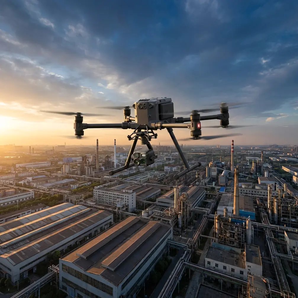
I spent the last cycle focused on one scenario: repeated inspection flights over vineyards in extreme temperatures, using Matrice 4 as a primary platform for thermal review, visual assessment, and mapping support. The mission profile sounds narrow. It is not. Vineyards are one of the better stress tests for any enterprise UAV because they combine repetitive geometry, subtle crop stress signals, elevation changes, long rows, reflective surfaces, and tight decision windows. If your aircraft, payload logic, and transmission habits hold up here, they usually translate well to broader agricultural and industrial inspection work.
What follows is not a generic overview. It is a field report built around the practical issues that matter when the aircraft has to produce usable evidence, not just fly.
Why vineyard inspection pushes a drone harder than many operators expect
A vineyard rewards precision and punishes inconsistency.
From above, rows can look orderly enough to make the job seem simple. In reality, the useful signals are often small. A thermal signature can shift just enough to indicate irrigation imbalance, blocked emitters, drainage issues, disease pressure, or localized canopy stress, but not enough to stand out unless flight timing, altitude, overlap, and image quality are controlled. In extreme heat, those differences can be exaggerated in some windows and masked in others. In colder conditions, thermal contrast may improve in one part of the day and flatten in another.
That is why Matrice 4, in this context, should be treated as a data-acquisition instrument first and an aircraft second. Stable route execution, dependable transmission, and efficient battery handling matter because every weak link degrades interpretation later.
The first operational lesson: thermal signature means nothing without context
Thermal data has a reputation for clarity it does not always deserve.
In vineyards, you are not simply looking for “hot” or “cold.” You are looking for pattern deviation. One vine block warming differently from adjacent rows. A section of canopy holding moisture differently after irrigation. A strip along a slope line presenting a thermal shape that hints at runoff behavior rather than plant health. The aircraft can capture these differences, but only if the mission is built around repeatability.
That means flying comparable routes at comparable times. It means maintaining disciplined altitude and overlap if photogrammetry products will be layered with thermal observations later. It also means accepting that thermal imagery alone can mislead. A stressed vine, bare soil exposure, a trellis shadow, and residual heat stored by nearby infrastructure can all complicate a read.
This is where combining thermal signature review with photogrammetry becomes less of a nice extra and more of a requirement. When a thermal anomaly appears, a dense visual model helps determine whether the issue belongs to the canopy, the ground, the irrigation layout, or simple geometry. In practice, I have found that operators who separate these tasks too aggressively often lose time. One team sees the thermal irregularity. Another team later tries to verify it visually. The delay breaks the chain of interpretation.
With Matrice 4, the smarter pattern is to treat thermal scanning and photogrammetry planning as parts of the same inspection logic, even when they are flown as separate missions.
Extreme temperatures change the mission before takeoff
A lot of vineyard operators focus on what the aircraft can see in harsh weather. The better question is how harsh weather changes the aircraft’s behavior and your tolerance for error.
In high heat, battery efficiency becomes part of data quality. If your endurance shrinks, you may be tempted to widen line spacing, reduce overlap, or compress the mission into fewer passes. That saves time in the air and costs clarity in processing. In cold conditions, voltage behavior at launch becomes a different type of planning issue. Flights that look straightforward on paper become fragile when the power margin tightens.
This is where hot-swap batteries matter in the field more than many people admit. Not because swapping is convenient, but because it preserves mission continuity. In a vineyard, continuity matters. Light changes. Shadows move. Wind shifts. The longer the pause between segments, the more likely your comparison across blocks becomes less reliable. Hot-swap capability shortens that interruption and helps keep environmental conditions within a tighter envelope.
For repeated inspections, especially where growers are trying to compare thermal response across time, that continuity is not trivial. It is one of the quiet factors that separates anecdotal drone imagery from decision-grade drone evidence.
The signal problem nobody talks about enough: electromagnetic interference in agricultural environments
People often imagine signal issues as urban problems. Steel, dense radio noise, rooftop clutter. Vineyards can be cleaner, but they are not interference-free.
Pump stations, utility lines, nearby agricultural equipment, weather systems, site topography, and even your own position relative to the aircraft can complicate transmission quality. On one recent inspection, the O3 transmission link stayed usable, but not clean. We were operating near a cluster of powered irrigation controls and a line of infrastructure that introduced intermittent interference signatures strong enough to degrade confidence, especially on a route where the aircraft had to work beyond a slight ridge.
The fix was not dramatic. It was disciplined.
We stopped treating the controller like a passive object and adjusted antenna orientation deliberately in relation to aircraft position and terrain. That sounds basic. It is. Yet it is one of the most neglected habits in commercial field work. Operators often launch, establish picture, and then hold the controller in whatever position feels natural. Under interference pressure, that laziness costs link stability.
With the Matrice 4, the practical takeaway was simple: when the aircraft changed bearing relative to us and started moving toward a zone with more competing noise, we reoriented stance and antenna angle to preserve a cleaner path. The result was more than a smoother live view. It reduced hesitation during image acquisition and protected the consistency of our route execution.
For anyone considering BVLOS planning in large agricultural properties where regulations and approvals allow it, this point scales up quickly. Transmission integrity is not just a convenience feature. It is the foundation of safe, reliable remote observation and route confidence. Strong O3 transmission performance helps, but field technique still matters. Hardware is not a substitute for operator awareness.
Why AES-256 belongs in the vineyard conversation
Most growers do not ask about encryption first. They should ask about it more often.
High-value vineyards are operationally sensitive environments. Maps, plant-health trends, irrigation patterns, and infrastructure layouts are all forms of business intelligence. If your inspection program is generating repeatable orthomosaics, thermal records, and trend comparisons, that dataset becomes strategically meaningful.
AES-256 matters here because agricultural inspection is increasingly less about one-off flights and more about accumulated digital assets. The better your data, the more responsibility you have to protect it in transit and in workflow design. For consultants managing multiple sites or handling third-party analysis, secure transmission and responsible data handling are not technical luxuries. They are part of professional credibility.
In practical terms, security also supports adoption. Vineyard owners who are hesitant about aerial documentation often become more comfortable when they understand that the system and workflow are built to protect operational information, not merely capture it.
GCPs still matter, even when automation is good
There is a temptation in modern drone mapping to trust automation until it disappoints you.
For vineyard work, Ground Control Points are still one of the best ways to tighten confidence in photogrammetry outputs, especially when terrain undulates or when you need change detection from one survey to the next. Vine rows create repetitive visual structure. Repetition can be efficient for agriculture. It can also be unforgiving during reconstruction if your workflow gets casual.
A Matrice 4 mission designed for vineyard mapping should not assume that onboard intelligence removes the need for survey discipline. GCP placement, clear marking, and consistent capture strategy can make the difference between a map that looks good and a map you are willing to compare across weeks or months. That distinction matters when a grower is deciding whether a stress pattern is expanding, stabilizing, or merely appearing different because the model alignment shifted.
I have seen teams collect decent imagery and then lose interpretive value because they treated GCPs as optional. In steep or irregular vineyard sections, that usually catches up with them.
A note on timing: when to fly if the weather is doing the opposite of what you want
Extreme temperatures rarely arrive alone. They bring wind behavior, haze, stronger reflections, colder starts, or mid-day thermal saturation.
In heat, early flights are often cleaner for visual mapping, but not always ideal for the thermal questions you care about. In cooler periods, later windows may reveal canopy differences more effectively, though wind may increase. The answer is not to hunt for a mythical perfect slot. The answer is to decide what question the mission is supposed to answer.
If the goal is irrigation diagnosis, your thermal strategy may differ from a structural trellis inspection or from a photogrammetric surface model of erosion-prone ground between rows. The Matrice 4 becomes more valuable when each flight has a narrow analytical purpose instead of trying to satisfy every objective at once.
That is one reason I advise operators to log not only route parameters, but also environmental intent: why this time, why this altitude, why this overlap, why this lens mode. Those records become essential when the same block is surveyed repeatedly under different conditions.
What the field data really gave us
The most useful outcome was not one dramatic discovery. It was the ability to separate noise from signal.
We identified canopy zones with recurring thermal deviation, correlated them with visual and structural indicators from mapping outputs, and ruled out several false positives that would have wasted time on the ground. We also improved our confidence in route planning under difficult signal conditions simply by handling antenna position more actively and respecting how local interference was shaping the transmission environment.
That sounds procedural because it is procedural. Vineyard inspection becomes more valuable as it becomes less theatrical. The best Matrice 4 operations are not the ones with the most eye-catching screenshots. They are the ones that produce repeatable, interpretable evidence under pressure.
For teams building these programs internally, that means training should emphasize transmission behavior, environmental timing, GCP discipline, and battery-transition logic as much as camera settings. For consultants running inspection services, it means presenting findings with enough context that the client understands not just what was seen, but why the flight design supports the conclusion.
If you are refining a vineyard workflow and want to compare notes on transmission setup, thermal interpretation windows, or mapping control strategy, you can reach me here: message me directly on WhatsApp.
The bigger lesson for Matrice 4 users
Matrice 4 earns its place in vineyard inspection not because vineyards are easy, but because they are not.
They force the operator to think in layers: aircraft reliability, transmission integrity, thermal context, mapping accuracy, secure data handling, and field continuity. In extreme temperatures, every shortcut becomes visible. Weak battery planning disrupts the dataset. Casual antenna handling degrades the mission. Skipping GCPs weakens comparison. Treating thermal imagery as self-explanatory leads to false confidence.
The operators who get the most from the platform are the ones who connect these pieces.
That is the real story from the field. Not whether the aircraft can fly over vines. It can. The real question is whether your workflow can turn a difficult environment into information that stands up to scrutiny. When built properly, Matrice 4 does exactly that: it helps convert a vineyard from a visually repetitive landscape into a measurable system, even when the temperature is working against you.
Ready for your own Matrice 4? Contact our team for expert consultation.