Matrice 4 for Mountain Vineyard Inspection: Flight Altitude
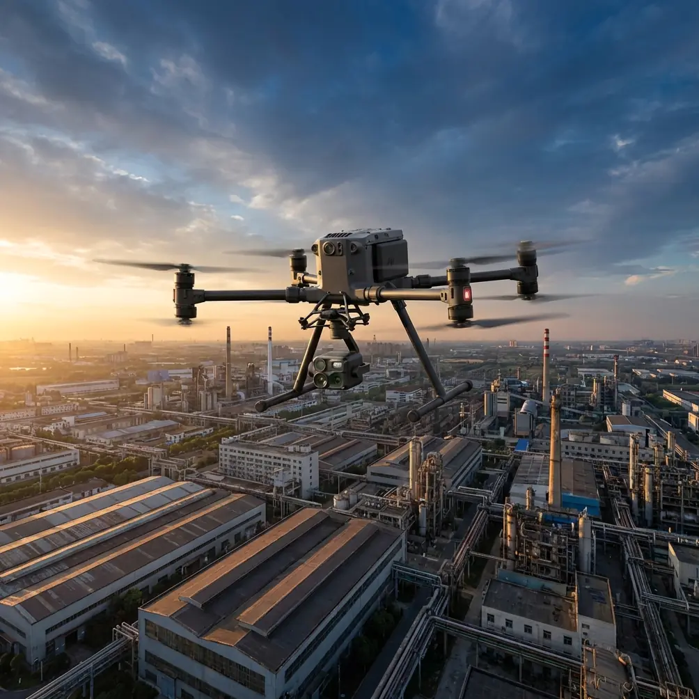
Matrice 4 for Mountain Vineyard Inspection: Flight Altitude, Turbulence, and Alert Discipline That Actually Matter
META: A practical Matrice 4 tutorial for mountain vineyard inspection, covering optimal flight altitude, photogrammetry, thermal workflows, turbulence response, sunlight readability, and safer field operations.
Mountain vineyards expose every weakness in an inspection workflow.
The rows are uneven. Slopes change abruptly. Wind behaves badly near ridgelines. Light bounces off leaves, rock, irrigation hardware, and netting in ways that can fool both sensors and pilots. If you are planning to use Matrice 4 in this environment, the right question is not simply whether the aircraft can fly the mission. It is whether your flight profile, visual alert strategy, and data capture plan are robust enough for terrain-driven disturbance.
That is where this gets interesting.
Most vineyard articles stay at the level of “use RGB for mapping” and “use thermal for plant stress.” Useful, but shallow. In mountain terrain, the harder problem is keeping image quality and pilot awareness consistent while the aircraft is being pushed around by local airflow and changing illumination. The reference material behind this article points to two engineering realities that matter directly in the field: aircraft response to atmospheric disturbance, and the reliability and readability of warning systems under difficult lighting.
Those may sound like design-manual issues. For a Matrice 4 operator inspecting vines on a slope, they are operational issues.
The first priority: choose altitude for the terrain, not for a flat-field template
If I were advising a team inspecting vineyards in the mountains with Matrice 4, I would start with altitude before I talk about camera modes.
A flat agricultural template can break down fast on a hillside. The reason is simple: the effective height above canopy keeps changing unless you actively manage it. That affects ground sample distance, overlap, image geometry, and the credibility of any later photogrammetry output. It also affects thermal interpretation, because the same stressed block can look different when the sensor-to-target distance varies too much across a mission.
For most mountain vineyard inspection work, a practical starting point is 50 to 80 meters above canopy, not above takeoff point. That range is often high enough to smooth out small terrain undulations and maintain stable corridor coverage, yet low enough to preserve useful detail for row-level analysis. For disease scouting or irrigation anomaly review using thermal signature and RGB side-by-side, I usually prefer the lower end of that band when legal and safe, especially if the vine structure is dense and the operator wants to compare canopy temperature variation across adjacent rows.
Why this range?
Because mountain vineyards create three competing demands:
- You need enough height to keep the aircraft from constantly chasing slope changes.
- You need enough detail to see row-level inconsistency, not just block-level averages.
- You need enough stability for repeatable overlap and sensor interpretation.
At very low altitude, the aircraft may collect beautiful detail but spend the entire mission reacting to terrain, turbulence, and rapid perspective changes. At very high altitude, you get smoother geometry but can lose the subtle canopy patterns that matter in viticulture.
The right answer is rarely a single number. It is a band, adjusted by slope angle, row spacing, wind, and the purpose of the inspection.
Why turbulence matters more in vineyards than many teams expect
One of the source references discusses engineering methods for calculating how an aircraft responds to continuous turbulence and wind shear, including both longitudinal and lateral response. That matters here because a mountain vineyard is a textbook place for disturbed air.
In practice, the aircraft may encounter:
- upslope thermal lift in the late morning,
- mechanical turbulence near terraces and retaining structures,
- cross-slope gusts that affect yaw and roll,
- sudden wind gradient changes when crossing a ridge shoulder.
These are not abstract aerodynamic concepts. They show up in your data as blurred imagery, uneven overlap, inconsistent thermal readings, or a pilot workload spike right when the aircraft is lined up over the most valuable block.
The manual also notes that problems discovered late in development are costly and difficult to fix once the aircraft design is largely set. For operators, the equivalent lesson is this: if your mission design ignores disturbance early, you end up trying to “fix” bad data after the flight. That rarely works well.
For Matrice 4 mountain inspections, apply that lesson before takeoff:
- Fly terrain-following or segmented altitude plans where possible.
- Avoid ridge-crossing legs at the start of a precision mapping run.
- Use crosshatch mapping only if wind allows consistent tracking; otherwise, a well-planned single-grid pass can be more reliable.
- Schedule thermal missions when solar loading and convective turbulence are both under control, often early morning.
- Leave margin in battery planning for repositioning if one hillside face is rougher than forecast.
This is where the LSI hint around hot-swap batteries becomes operationally meaningful. On a mountain property, the cost of forcing one long mission beyond ideal air conditions is often higher than splitting the job into shorter windows. If your workflow supports quick turnaround in the field, you can preserve data quality instead of pushing through deteriorating wind.
Critical roll and coupled motion: why your map edges get messy
Another reference detail worth pulling into a vineyard workflow is the discussion of critical roll rate and the use of simplified and more accurate formulas to identify dangerous coupled flight states. The original context is aircraft motion analysis, but the field takeaway is very practical.
When a drone flies quick lateral transitions over sloped terrain in gusty air, roll, pitch, and yaw do not behave independently. The aircraft may remain well within safe limits, yet the camera payload still suffers from transient orientation changes that degrade stitching and edge consistency. This is especially noticeable when the mission includes abrupt line entries, aggressive turns at row ends, or sidewind corrections over narrow terraces.
Operational significance:
- If your orthomosaic edges look less reliable on one side of the block, it may not be a software issue. It may be coupled motion during line changes.
- If your thermal layer appears spatially “soft” in just one zone, the cause may be local airflow rather than sensor failure.
- If one slope face always produces noisier data, reduce speed and widen turns there before changing camera settings.
I generally recommend slower groundspeed on mountain vineyard lines than teams use on broad flat farms. Not because Matrice 4 lacks performance, but because a stable sensor path beats a fast mission with compromised geometry. Precision agriculture is full of examples where the best efficiency move is actually restraint.
Photogrammetry in vine blocks: use GCPs selectively, not ceremonially
Mountain vineyards tempt people into one of two mistakes. Either they skip ground control entirely because RTK-grade onboard positioning looks good enough, or they oversaturate the site with GCPs in places that do not improve the final model.
A better approach is to place GCPs where elevation change, row curvature, or block transitions can distort the reconstruction. In steep terrain, a few well-positioned points often outperform a larger number placed casually. Focus on breaklines, terrace changes, and the far ends of long sloped sections.
This matters because varying flight height and terrain angle already challenge your geometry. If you add poor control placement, you can get maps that look clean visually but drift in the exact areas where agronomic decisions matter.
For vineyard managers using Matrice 4 outputs to compare vigor, drainage behavior, erosion patterns, or access-road condition, that spatial discipline is not optional. It is the difference between a credible baseline and a misleading one.
Thermal signature: read the vines, but also read the terrain
Thermal data from vineyards can be powerful. Water stress, clogged irrigation sections, uneven canopy development, and disease-related anomalies can all create useful thermal contrast. In mountain terrain, though, thermal interpretation must account for slope orientation and sunlight history.
A south-facing block and a shaded east-facing block may show very different thermal behavior even when vine health is similar. The smart play is to compare like with like:
- same time window,
- similar exposure,
- repeatable altitude above canopy,
- consistent flight direction where possible.
This is another reason I like the 50 to 80 meter above-canopy starting band. It gives enough room for smooth coverage while keeping thermal resolution meaningful. If the goal is block triage rather than vine-by-vine diagnosis, the upper part of that range is often fine. If the goal is identifying subtle irrigation irregularities, come lower if the terrain and regulations allow.
Do not let beautiful color palettes fool you. Thermal interpretation without terrain discipline is often just decorative confusion.
O3 transmission and AES-256: useful, but only when the workflow around them is disciplined
The context hints include O3 transmission and AES-256. Both are relevant in mountainous vineyards, though not for the reasons marketing copy usually gives.
Transmission quality matters because ridges, tree lines, service roads, and changing aircraft aspect can interrupt or degrade signal paths. In real operations, strong link performance helps the pilot maintain confidence when the aircraft moves behind a terrain shoulder or along a folded slope. But a good link is not permission to become casual about line planning. It is a buffer, not a substitute for mission design.
Similarly, AES-256 matters when the vineyard operator treats imagery and thermal outputs as sensitive operational data. Estate layouts, irrigation networks, yield patterns, and crop stress maps can all be commercially sensitive. Secure transmission and handling are relevant, especially for premium producers or contracted agronomy teams. Yet encryption only solves part of the problem. You still need disciplined file workflows, crew permissions, and controlled export practices.
Technology can support professionalism. It does not replace it.
Alerts in bright mountain light: the overlooked safety factor
The second source document is about cockpit warning design, and one detail jumps out for drone field operations: readability in direct sunlight above 10×10⁴ lx, with the requirement that energized warning text be clearly visible, while de-energized text should not be mistakenly perceived as active. Another key detail is reliability through redundancy, such as at least two parallel bulbs or a dual-filament lamp, so one failure does not make the alert ineffective.
Now translate that into a vineyard workflow.
In mountain operations, teams often launch from exposed roads, terraces, or field margins under intense sun. The pilot may be glancing between controller, aircraft position, terrain, and crew. If the alert presentation on the controller or attached display is hard to interpret in glare, decision speed drops. That is not just annoying. It can affect battery calls, link response, obstacle awareness, and return planning.
Operational significance:
- Use display brightness aggressively in mountain daylight; do not wait until visibility becomes marginal.
- Configure alert priorities so only meaningful warnings interrupt the mission.
- Before launch, verify that the pilot can distinguish active warnings from inactive labels in full sun, not just in the vehicle shade.
- Build redundancy into your field kit mindset, even if you are not dealing with literal dual-filament lamps. Spare screens, backup power, and cross-check procedures serve the same purpose: one failure should not erase situational awareness.
This is where mature operators separate themselves from casual users. They know that “seeing the warning” is part of flight safety and data integrity, not an administrative detail.
A practical tutorial workflow for Matrice 4 in steep vineyard terrain
Here is the sequence I recommend.
1. Define the inspection objective before picking the mission mode
If the goal is canopy vigor mapping, your altitude, overlap, and timing differ from a mission focused on thermal irrigation anomalies or erosion inspection along vineyard roads.
2. Walk the launch site and identify disturbance zones
Look for ridge breaks, saddles, terrace walls, tall trees, and narrow gullies. These are where local airflow often becomes ugly.
3. Set a starting altitude of 50 to 80 meters above canopy
Adjust down for finer thermal or visual detail, up for smoother terrain management and safer line consistency.
4. Plan slower passes on the most exposed slope faces
This reduces the impact of coupled roll-pitch-yaw disturbances on image geometry.
5. Use GCPs where the terrain changes character
Do not scatter them evenly just because that feels methodical. Put them where they solve actual geometric risk.
6. Schedule thermal flights conservatively
Early morning often works best, before solar heating and convective turbulence distort the picture.
7. Check sunlight readability of the pilot interface before launch
The source benchmark of direct sun visibility is a reminder that warnings must be unmistakable under harsh illumination.
8. Split long jobs into shorter sorties
Use your battery workflow intelligently. In mountain vineyards, forcing one giant mission usually creates more problems than it solves.
9. Protect the data path
If you are handling commercially sensitive estate information, treat secure transmission and file handling as part of the mission, not as office cleanup.
10. Review anomalies against terrain and wind history
Do not assume every odd thermal patch is agronomic. Some are environmental artifacts.
When BVLOS enters the conversation
The context mentions BVLOS, and it is easy to see why vineyard operators ask about it on large estates spread across mountain contours. The temptation is understandable. Long rows, distant blocks, and road access limitations make extended-range operations attractive.
But the more useful lens is not range. It is control quality and regulatory fit. In mountainous vineyards, terrain masking, localized wind behavior, and variable signal geometry can complicate remote awareness. If a BVLOS framework is legal in your area and supported by your operational approvals, it should still be built around terrain analysis, communications resilience, emergency planning, and a data objective worthy of the added complexity.
If you are still refining your basic altitude and coverage discipline, do that first.
Final field insight: altitude is a data quality decision, not just a flight parameter
If there is one idea I want vineyard teams to keep from this piece, it is this:
Optimal altitude in mountain vineyard inspection is really a compromise between sensor usefulness and disturbance tolerance.
Too low, and the mission becomes overly sensitive to slope, gusts, and canopy variation. Too high, and you flatten the very patterns you came to measure. For many Matrice 4 inspections, starting around 50 to 80 meters above canopy is the sweet spot worth testing, then refining by block type and mission intent.
And do not ignore the two engineering lessons hidden in the references. First, aircraft response to turbulence and coupled motion is not theoretical in mountain terrain; it directly shapes map quality and pilot workload. Second, alert visibility and redundancy matter under strong sun because field decisions are only as good as the warnings the crew can clearly perceive.
If you are building a vineyard inspection routine around Matrice 4 and want to compare flight plans, terrain strategies, or sensor settings for a specific estate, you can message Dr. Lisa Wang’s field desk here.
Ready for your own Matrice 4? Contact our team for expert consultation.