Matrice 4 for Vineyard Monitoring in Low Light
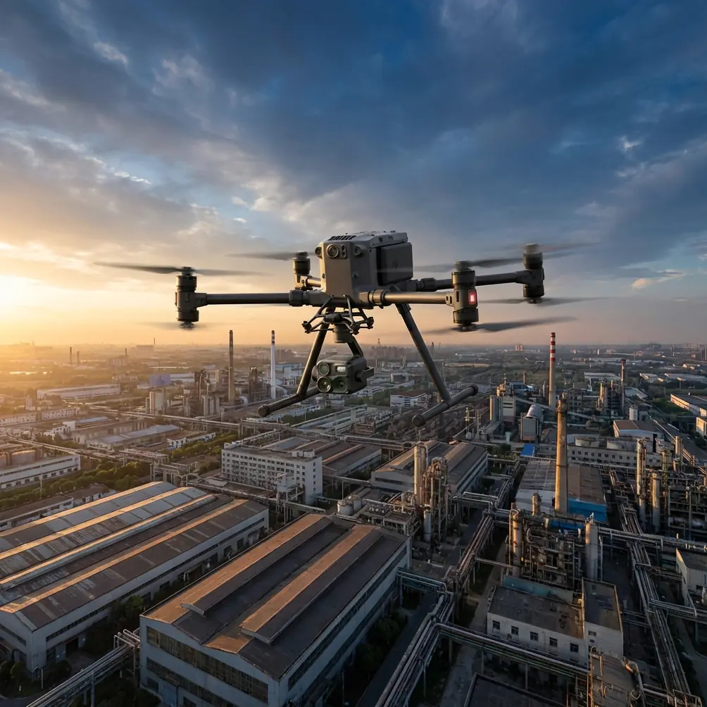
Matrice 4 for Vineyard Monitoring in Low Light: A Field Method That Actually Works
META: Expert how-to for using Matrice 4 in vineyards at low light, covering flight altitude, thermal signature, photogrammetry workflow, remote data transmission, and vehicle-based rapid mapping operations.
Low-light vineyard monitoring is rarely just about seeing in the dark. The real job is collecting usable information quickly enough to act on it: blocked irrigation lines, cold-stressed rows, drainage issues, patchy vigor, animal intrusion, and disease-related anomalies that start subtly and spread fast. That is where the Matrice 4 conversation gets interesting.
Most articles stop at the aircraft. That misses the operational reality. In the field, the drone is only one part of a working system. The more useful model comes from emergency surveying practice: integrate remote sensing, GIS, GPS, and network communications into one flow so imagery can be acquired, processed, and transmitted fast. A vehicle-based UAV mapping system was specifically described in the reference material as a way to achieve rapid image capture, on-site processing and output, plus immediate remote transmission. That logic translates surprisingly well to vineyard work at dawn, dusk, and overcast low-light windows.
For growers, vineyard managers, and service providers using Matrice 4, the takeaway is simple: low-light success depends less on flying higher-tech missions and more on building a tighter workflow from takeoff to decision.
Why low-light vineyard flights need a different plan
A vineyard is not an open field in the abstract. It is a structured environment with repeating rows, gaps, posts, wires, slope changes, drainage channels, access roads, and edge vegetation. In low light, those features can either help or hurt image interpretation depending on sensor choice and flight design.
Visual imagery loses contrast first. Shadows lengthen. Uniform canopies flatten. Row-to-row differences become harder to separate. Thermal data, on the other hand, can become more revealing in these conditions because temperature separation between vine rows, bare soil, moist zones, and stressed plants often shows up before the sun washes the scene out. That makes thermal signature analysis especially valuable around first light, last light, and cool transitional periods.
But thermal alone is not enough if your goal is repeatable vineyard management. You still need location integrity, clean mapping geometry, and a way to share findings without waiting until the team gets back to the office. This is exactly where the reference document matters operationally. It framed a key constraint in emergency mapping as the need to make remote sensing data acquisition, processing, and remote transmission fast and efficient. Swap “disaster zone” for “vineyard block before the crew rolls out,” and the same bottleneck appears.
If you want Matrice 4 to produce decisions rather than just images, build the mission around speed, geospatial confidence, and immediate data handoff.
The best flight altitude for low-light vineyard monitoring
For this scenario, my preferred starting altitude is 35 to 45 meters above ground level for thermal inspection of vineyard rows, then 50 to 70 meters if I also need broader photogrammetry coverage across multiple blocks.
Why that range?
At 35 to 45 meters, you usually get a strong balance between row-level thermal separation and efficient coverage. You are low enough to distinguish recurring patterns within individual rows and enough of the inter-row temperature behavior to spot drainage issues, weak sections, or irrigation irregularities. Go much lower and you may increase detail, but you also multiply flight time, battery cycles, and stitching burden. Go much higher and thermal averaging starts to hide the subtle anomalies that matter most in vineyards.
At 50 to 70 meters, you gain efficiency for orthomosaic creation and broader block comparison. This is useful when the job is less about one suspicious area and more about documenting conditions across a larger property. If you are planning photogrammetry outputs for management records, this higher range often produces smoother mission logistics without sacrificing the row structure needed for useful mapping.
A practical rule:
- 35–45 m AGL: targeted thermal scouting, drainage patterns, stress localization, low-light anomaly detection
- 50–70 m AGL: broader photogrammetry and multisector overview mapping
- One altitude is rarely enough: run a quick thermal diagnostic mission first, then a mapping mission if needed
In steep or terraced vineyards, keep the aircraft’s height consistent relative to terrain, not launch point. Otherwise, your effective ground sampling and thermal interpretation will vary across the block.
Build the mission like a mobile mapping unit, not a standalone drone flight
The most useful idea from the reference paper is not the hardware form factor. It is the system architecture. The authors described integrating remote sensing, geographic information systems, global positioning systems, and network communication technology into a vehicle UAV emergency surveying and mapping system. They emphasized rapid acquisition of remote sensing imagery, timely on-site processing and output, and immediate remote transmission.
That is a strong blueprint for vineyard operations.
Here is what that looks like with Matrice 4 in practice:
1. Use the vehicle as the field command point
Do not treat the pickup or utility vehicle as transportation only. Treat it as the processing and coordination node.
From that point, you can:
- plan missions block by block
- verify GNSS conditions
- log vineyard sections in GIS layers
- review thermal anomalies immediately after landing
- push findings to a remote agronomist or manager
This matters because low-light windows are short. If you wait until the end of the day to process, the value of the flight drops.
2. Standardize your geospatial references
If the mission is purely qualitative, onboard positioning may be enough. If you want to compare one week to the next, tie the operation to repeatable references. That can mean GCPs for photogrammetry-grade deliverables or at least consistent takeoff zones and mapped block boundaries.
GCP use is often dismissed in vineyards because row geometry already “looks aligned.” That is not the same as having dependable spatial consistency. If your objective is to track whether a cool patch is migrating downslope or whether a weak row segment expanded by 8 or 12 meters, positional discipline matters.
3. Process in the field, not just later
The reference source highlighted 现场及时处理和输出 — timely on-site processing and output. That phrase is easy to overlook, but for vineyards it is one of the highest-value concepts in the entire workflow.
Field processing lets you answer questions while you are still there:
- Was the altitude right?
- Did the thermal contrast hold?
- Is the suspicious block really different, or was it edge effect?
- Do you need a second pass lower and slower?
- Should the irrigation team check one sector today?
That kind of loop is where professional operations outperform casual drone flying.
A low-light Matrice 4 workflow for vineyards
Here is the method I recommend.
Step 1: Fly before the thermal picture gets noisy
Aim for a period when canopy and ground temperature differences are interpretable, not overwhelmed by direct solar heating. In most vineyard settings, that means early morning or late evening. Cloudy low-light periods can also be useful.
The target is not darkness for its own sake. The target is stable thermal contrast.
Step 2: Start with a fast reconnaissance pass at 45 meters
Run a thermal-first mission over the priority blocks. Keep overlap sufficient for review and mapping continuity, but do not overbuild the mission. You are trying to identify where to look closer.
At this stage, watch for:
- repeated cool or warm breaks along the same row
- temperature shifts near line ends
- unusual signatures around drainage paths
- isolated hot spots near equipment or infrastructure
- edge effects from roads, rocks, or tree lines
Step 3: Drop lower only where the first pass reveals a story
If one section stands out, rerun it around 35 meters. This is often where the difference between “possible issue” and “actionable issue” appears. You may be able to separate a row-wide pattern from a single-vine anomaly, or distinguish irrigation asymmetry from soil thermal carryover.
Step 4: Run a photogrammetry pass if the issue needs mapping-grade context
Once the thermal anomalies are identified, a second mission at 50 to 70 meters can build broader context. This is where photogrammetry supports operational decisions. Managers often need to see thermal findings against rows, service roads, tanks, slope lines, and block boundaries. A visual map can make that interpretation far easier.
If long-term repeatability matters, add GCPs or maintain a consistent control framework.
Step 5: Transmit the findings while the crew is still in the field
This is where the reference document becomes directly relevant again. It did not just focus on image collection. It identified remote data transmission as part of the capability stack required for rapid surveying support. In a vineyard business, that means the drone team should be able to move outputs off the aircraft and into the decision chain fast.
That may be as simple as sharing quick-look thermal screenshots and georeferenced notes to an agronomy lead, or sending packaged field results to a remote operations desk. If you are building a more connected workflow around O3 transmission and secure handling of sensitive farm location data, keep the communication path disciplined. For teams concerned with data protection, encrypted handling such as AES-256 in the broader workflow is worth considering, especially when vineyard health data is linked to production planning.
If you need a fast way to coordinate a field workflow or compare deployment options, you can reach out here: message the team directly.
Why O3 transmission and remote handoff matter in vineyards
People tend to discuss transmission systems as if they are only about pilot convenience. They are not. In commercial vineyard work, transmission quality affects the tempo of decisions.
Reliable O3 transmission supports:
- cleaner live situational awareness when working along long row corridors
- better confidence when checking anomalies before committing to a second pass
- smoother coordination between pilot and observer or farm manager
- reduced delay between capture and verification
That same principle echoes the reference paper’s central problem: emergency mapping capability is limited when data acquisition, processing, and transmission are too slow. Vineyard operations may be less dramatic, but the business impact is still real. If a crew can inspect a suspect irrigation sector the same morning instead of the next day, the drone mission did its job.
Battery strategy matters more than most pilots admit
Low-light windows do not last long. Hot-swap batteries are not a luxury in this scenario. They preserve momentum.
A vineyard survey often unfolds in stages:
- broad thermal pass
- focused revisit
- context mapping pass
- spot verification over edge cases
If every battery change turns into a reset, the window closes. Hot-swap capability helps the team keep the aircraft cycling while the field vehicle handles review and data organization. That is another reason the vehicle-based operating model from the reference material is so useful. The aircraft, batteries, laptop, GIS layers, network link, and field notes all stay in one moving system.
Can BVLOS concepts help with vineyard scale?
On very large estates, operators naturally think about BVLOS-style efficiency. The right approach depends on local regulations and approval pathways, so the mission has to stay compliant. But even without formal BVLOS operations, you can borrow the planning mindset: reduce deadhead flight, segment blocks logically, pre-stage launch points, and maintain strong communication links.
The lesson is not “fly farther.” The lesson is “design for continuity.”
The real value of Matrice 4 in this role
Matrice 4 becomes compelling in vineyards when it stops being a standalone aircraft and starts functioning as part of a mobile remote sensing system. That is the strongest insight hidden in the source material. The paper described a system intended to improve surveying support by integrating technologies and enabling fast acquisition, on-site processing, and immediate remote transmission. Those are not abstract engineering goals. They are exactly what a vineyard manager needs during low-light monitoring.
Operationally, two details from the reference stand out:
- The system combines remote sensing, GIS, GPS, and network communication. In vineyard monitoring, that combination turns raw imagery into mapped, located, shareable findings rather than disconnected screenshots.
- The system emphasizes rapid data processing and remote transmission. In vineyard terms, that shortens the gap between spotting a thermal anomaly and dispatching a field team to inspect the right row before conditions change.
That is the difference between drone activity and decision support.
If your low-light vineyard mission is producing pretty images but not changing what happens on the ground, the fix is usually not a new aircraft setting. It is a better field architecture: tighter altitude choices, thermal-first scouting, repeatable geospatial control, vehicle-based review, and immediate data handoff.
Get those right, and Matrice 4 becomes a serious vineyard monitoring tool rather than just another drone with a camera.
Ready for your own Matrice 4? Contact our team for expert consultation.