Monitoring Urban Vineyards with Matrice 4: Flight Height
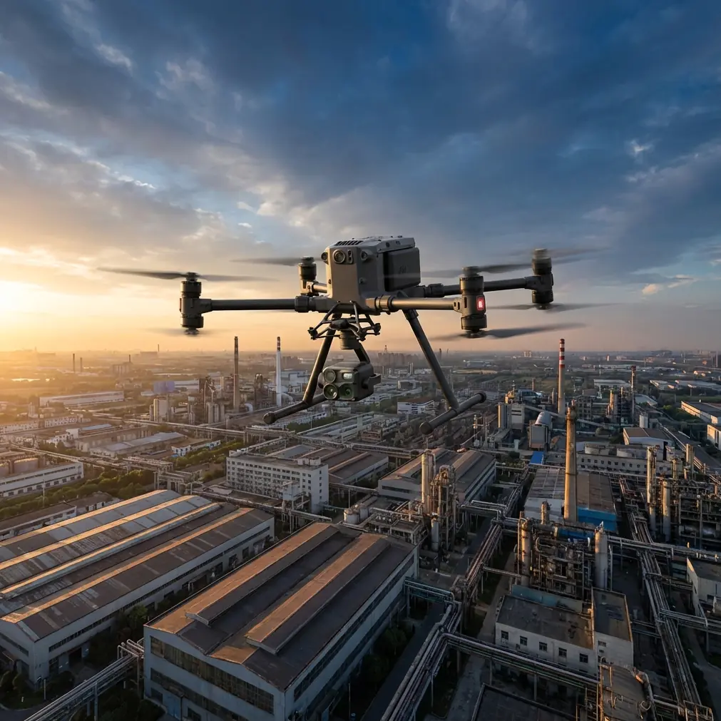
Monitoring Urban Vineyards with Matrice 4: Flight Height, Leak Discipline, and Data Quality
META: Practical Matrice 4 tutorial for monitoring vineyards in urban settings, with flight altitude guidance, thermal workflow insight, and precision lessons drawn from aircraft engineering tolerances.
Urban vineyards ask more from a drone program than open-field agriculture ever will. Space is tighter. Airspace is fussier. Heat behaves strangely around buildings, roads, walls, and hardscape. And the margin for sloppy data collection shrinks fast when every row sits next to homes, traffic, or mixed-use property.
That is exactly where a Matrice 4 workflow needs to be more deliberate.
I’ve seen many operators approach vineyard monitoring as if the aircraft alone solves the problem. It doesn’t. The platform matters, especially if you are using O3 transmission, AES-256-secured data handling, thermal signature review, and photogrammetry in the same operation. But in urban viticulture, the bigger advantage comes from discipline: choosing the right flight altitude, controlling repeatability, and treating small deviations as meaningful before they become expensive.
Oddly enough, one of the best ways to think about that discipline comes from older aircraft engineering references, not marketing sheets. In a hydraulic sealing context, the source material stresses that leakage often begins with extremely brief contact loss—so brief that the increase is hard to notice at first. It also specifies tight cleanliness and geometry expectations, including recommended filtration in the 5 to 10 pm range and bore roundness limits of 0.0005 inches per inch of diameter. Those are not drone specs. But the operational lesson maps directly onto vineyard drone work: small, transient quality failures are easy to miss, and by the time they are visible in your maps or thermal layers, the useful precision may already be gone.
For urban vineyard monitoring with Matrice 4, that matters more than most pilots realize.
Why flight altitude is the first real decision
If your mission is vine health monitoring in a built-up environment, the “best” altitude is not a single number. It is a balance between three competing needs:
- enough resolution to detect canopy variation row by row,
- enough height to keep a stable, safe buffer from trellises, poles, trees, and edge structures,
- enough consistency to make repeat flights comparable over time.
For most urban vineyard inspections, I recommend treating 50 to 70 meters above ground level as the practical starting band for RGB mapping, then adjusting based on row spacing, surrounding obstructions, and the output you actually need. That range usually gives a strong compromise between detail and operational calm. Below it, you may gain detail but lose efficiency and increase parallax issues near walls, pergolas, and irregular lot boundaries. Above it, you may cover ground faster but dilute the subtle canopy differences that matter for irrigation stress, disease spread, or vigor tracking.
Thermal work usually benefits from a slightly different mindset. If your objective is identifying irrigation irregularities, heat stress patterns, or patchy canopy response, you are not just chasing sharp imagery. You are trying to isolate meaningful thermal signature variation from environmental noise. In an urban vineyard, roofs, paving, parked vehicles, and masonry can all distort the thermal scene. That means flying too high can mix vine temperature data with surrounding heat sources, while flying too low can exaggerate angle effects and produce less consistent mosaics. In practice, many operators get cleaner analytical output by staying in the lower half of their mapping envelope and flying repeatable lines at a consistent time window.
The key is not merely altitude. It is altitude stability.
The hidden problem: micro-variation ruins trend analysis
The aircraft design reference makes a sharp point about cylinder geometry: tiny changes from temperature and pressure cycles can distort shape enough to increase leakage. It recommends limiting those micro-variations to 0.002 inches per inch of diameter wherever possible. Again, that has nothing to do with a vineyard directly. But the principle is perfect for Matrice 4 operations.
Urban vineyards create micro-variation everywhere:
- wind shear along building edges,
- GNSS multipath near reflective surfaces,
- shifting sun-shadow boundaries,
- thermal contamination from adjacent structures,
- inconsistent takeoff points that alter effective mission height.
Each one may appear minor. Together, they can wreck comparability between flights.
If you are building a recurring monitoring program, the goal is not just a good map today. It is a trustworthy sequence of maps over weeks and months. That means you should lock down the variables you can control:
Use the same launch point whenever possible.
A different curbside takeoff or terrace platform can subtly change effective height over the block.Keep flight altitude fixed for each monitoring series.
Don’t fly 45 meters one week and 75 the next unless the mission objective changes.Use GCPs when the vineyard footprint and compliance environment justify them.
In an urban parcel, even small geospatial shifts can create false interpretations around row edges and access lanes.Fly at the same time of day for trend work.
This is especially critical for thermal signature comparison.Keep overlap generous.
Urban vineyards often include edge clutter and vertical distractions that can confuse reconstruction if the mission is too lean.
Photogrammetry rewards consistency. Thermal analysis punishes inconsistency. Matrice 4 can do both well, but only if the operator behaves more like a survey lead than a casual pilot.
Clean systems make cleaner decisions
Another useful detail from the aircraft handbook is its recommendation for hydraulic filtration at 5 to 10 micrometers to reduce contamination at sealing surfaces. For drone operators, the direct translation is simple: contamination control is not glamorous, but it protects the whole chain.
In vineyard work, “contamination” is broader than dust on a sensor. It includes:
- smudged optics,
- thermal lens residue,
- inconsistent metadata,
- poor battery rotation records,
- rushed SD card handling,
- mixed coordinate references between flights.
Urban vineyard monitoring often happens in short windows. Crews are tempted to move quickly, swap batteries, and launch again. Hot-swap batteries are a real efficiency gain here, especially when you need multiple sorties without fully powering down the workflow. But speed only helps if the data chain stays clean. If one battery set is logged incorrectly, if one thermal lens has a fingerprint, or if one mission imports under the wrong project template, the resulting comparison can be misleading.
That’s where Matrice 4 operators should think beyond piloting. Build a preflight and postflight checklist that treats data integrity like a flight-critical component.
My own minimum checklist for this scenario includes:
- lens inspection before every sortie,
- thermal calibration check,
- mission template confirmation,
- battery pair tracking,
- memory status check,
- GNSS and home point validation,
- notes on ambient conditions and visible heat sources.
That may sound obsessive until you try explaining an apparent stress hotspot that later turns out to be a reflection pattern from a nearby glass facade.
O3 transmission and AES-256 matter more in the city
Rural vineyard missions often have a simpler RF environment. Urban vineyards do not. Signal congestion, Wi-Fi saturation, structures, and interference can all influence command reliability and live-feed confidence. A Matrice 4 workflow using O3 transmission has a real advantage in maintaining a stable operational link in these more complex environments, not because longer range is the headline, but because link stability supports better decision-making at the edge of legal and practical stand-off distances.
That does not mean you should lean into risky operations. It means you can maintain clearer situational awareness while preserving safer spacing from obstacles and neighboring properties.
The same logic applies to AES-256. Vineyard operators sometimes underestimate the sensitivity of their own data. But urban agricultural sites can sit amid commercial developments, residences, hospitality assets, or research plots. Thermal maps, crop health layers, irrigation patterns, and asset locations all have operational value. Secure handling is not a luxury feature. It is part of professional practice, especially when consultants, growers, landlords, and agronomists all touch the same information chain.
When BVLOS is the wrong question
Because Matrice 4 sits in a professional class, many readers jump quickly to BVLOS planning. For urban vineyard monitoring, that is often the wrong first question. The bottleneck is usually not raw aircraft capability. It is line complexity, airspace structure, and the need for consistent close-quarters data collection. In many urban sites, the smarter path is a compact, meticulously repeatable visual-line operation rather than stretching the mission envelope.
If you eventually develop a compliant BVLOS framework for larger estates or distributed blocks, fine. But for the typical urban vineyard, tighter mission architecture will produce better agronomic insight than bigger mission ambition.
Practical altitude guidance by task
If you want one usable framework for Matrice 4 in this setting, use this:
1. General canopy health mapping
Start around 60 meters AGL.
This is usually a strong middle ground for row-level review without sacrificing efficiency.
2. High-detail issue confirmation
Drop toward 40 to 50 meters AGL when you need closer examination of a suspected weak zone, irrigation inconsistency, or edge-effect problem.
3. Thermal stress review
Aim for repeatability first, often in the 45 to 60 meter band, and fly during a stable environmental window. Avoid comparing missions captured under dramatically different surface-heating conditions.
4. Boundary-sensitive urban parcels
If walls, power lines, mature trees, or rooftop turbulence are present, bias upward within your safe operating limits to preserve clearance and smoother geometry, then compensate with overlap and slower speed.
This is why there is no magic altitude. The optimal number depends on whether your priority is diagnosis, mapping efficiency, or repeatable trend detection.
A better way to judge mission success
Do not judge an urban vineyard flight by whether the aircraft returned with pretty imagery. Judge it by whether the data supports a management decision.
Can the grower clearly identify underperforming rows?
Can an agronomist compare this week’s thermal layer to last month’s without second-guessing altitude or environmental drift?
Can the site team trust the geospatial placement enough to dispatch ground checks accurately?
Can you defend your process if stakeholders ask why one block appears hotter than another?
That is where the engineering mindset from the reference material becomes useful. The handbook’s pressure test values—750 lb/in² and 3000 lb/in²—were used to assess seal assembly quality under demanding conditions. The deeper lesson is that systems should be tested against reality, not assumption. For Matrice 4 vineyard work, your equivalent pressure test is repeatability. If the workflow holds up across multiple flights, different days, and variable urban conditions, then you have something operationally valuable.
If it only works when conditions are perfect, you have a demo, not a program.
Final field advice for urban vineyard teams
If you are setting up a Matrice 4 routine for vineyard monitoring in an urban environment, do these five things first:
- choose one baseline altitude and defend it unless the mission objective changes,
- use thermal only when you can control timing and interpret surrounding heat sources correctly,
- standardize your photogrammetry workflow with overlap, naming, and GCP logic,
- treat hot-swap efficiency as useful only when paired with strict logging,
- protect your link and data chain with the same seriousness you bring to flight safety.
And if you are trying to refine a site-specific altitude plan for a constrained vineyard block, this is the kind of problem worth discussing with someone who has worked through urban interference, crop monitoring, and mapping consistency before. You can message a flight planning specialist here.
Matrice 4 is a strong platform. But in urban viticulture, the real edge comes from respecting the small things: tiny variations, clean data, and a repeatable altitude strategy that matches the biology of the vines, not just the capability of the drone.
Ready for your own Matrice 4? Contact our team for expert consultation.