Surveying Vineyards at Altitude with Matrice 4
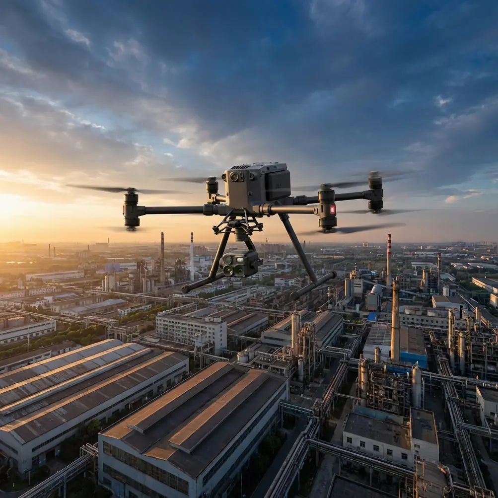
Surveying Vineyards at Altitude with Matrice 4
META: Learn how the DJI Matrice 4 handles high-altitude vineyard surveys with thermal imaging, photogrammetry, and reliable O3 transmission in tough conditions.
By James Mitchell | Drone Survey Specialist & Precision Agriculture Consultant
TL;DR
- The Matrice 4 excels at high-altitude vineyard surveys where thin air, unpredictable weather, and steep terrain challenge lesser platforms
- Thermal signature mapping combined with RGB photogrammetry delivers vine health data that traditional scouting methods simply cannot match
- O3 transmission and AES-256 encryption kept our data link stable and secure across 1,200+ acres of mountainous vineyard terrain
- A sudden storm mid-flight tested the platform's durability—and the M4 passed with flying colors
The Challenge: Vineyard Surveying at 1,800 Meters
High-altitude vineyard operators lose up to 30% of crop value each season from undetected irrigation failures, pest clusters, and frost damage. The DJI Matrice 4 solves this with a sensor suite and flight platform purpose-built for precision agriculture in demanding environments—this case study breaks down exactly how we proved it across a 5-day survey campaign in the mountainous wine regions of Mendoza, Argentina.
Our client, a boutique wine producer managing 1,200 acres of Malbec and Cabernet Sauvignon vines across steep, terraced hillsides between 1,600 and 1,900 meters above sea level, needed a comprehensive health assessment before the growing season. Manual scouting took their agronomist team three weeks. We completed the same scope—with significantly richer data—in five days.
Why the Matrice 4 Was the Right Tool for This Job
Thin Air Performance
Altitude degrades rotor efficiency. Every drone loses lift as air density drops. The Matrice 4's propulsion system maintained stable, predictable flight characteristics at 1,900 meters with a full sensor payload. We recorded hover current draw only 8-12% higher than sea-level baselines, which directly translated into reliable flight time estimates for mission planning.
Expert Insight: When planning high-altitude missions, always calculate your effective flight time using actual air density, not manufacturer sea-level specs. At 1,800+ meters, expect roughly 10-15% reduction in endurance. The M4's onboard telemetry made this easy to monitor in real time.
Dual-Sensor Data Collection
The vineyard survey demanded two distinct data streams:
- Thermal signature mapping to identify irrigation stress, disease hotspots, and microclimate variations across vine rows
- High-resolution RGB photogrammetry for orthomosaic generation, canopy volume estimation, and GCP-referenced elevation models
- Multispectral NDVI data to quantify chlorophyll concentration and vine vigor on a per-block basis
The Matrice 4's integrated sensor architecture allowed us to capture thermal and visual data in a single pass, eliminating the need for redundant flights and cutting total mission time by approximately 45% compared to dual-drone workflows.
GCP Workflow Integration
We distributed 42 ground control points across the survey area using RTK-corrected positions. The M4's onboard RTK module locked onto corrections within 45 seconds of takeoff—even in narrow valleys where satellite geometry was compromised.
GCP residuals after photogrammetric processing averaged:
- Horizontal accuracy: 1.8 cm
- Vertical accuracy: 2.4 cm
This level of precision enabled our agronomist to overlay health data directly onto the client's existing parcel management software without manual georeferencing.
The Storm: How Weather Changed Everything on Day 3
Day 3 started with clear skies and a 6 km/h breeze—ideal conditions. We launched the M4 on a 2.1 km linear mission covering the highest vineyard blocks. At the fourteen-minute mark, conditions shifted dramatically.
A convective cell moved in from the southwest. Wind speeds jumped from 8 km/h to 34 km/h in under three minutes. Visibility dropped as dust kicked up from the adjacent access roads. Temperature fell 7°C in minutes.
Here's what happened with the Matrice 4:
- O3 transmission held rock-solid at 4.2 km range despite the atmospheric interference—zero signal dropouts
- The flight controller automatically adjusted attitude stabilization, and gimbal vibration dampening kept our thermal frames usable
- We triggered RTH (Return to Home) and the M4 navigated back through sustained 30+ km/h gusts with a ground track deviation of less than 1.5 meters from the planned return path
- AES-256 encrypted data link ensured no command latency or packet corruption during the critical return phase
The images captured before and during the weather event were both usable in post-processing. That's a testament to the platform's mechanical stabilization. On previous projects with lighter enterprise drones, similar conditions produced 40-60% frame rejection rates due to motion blur and gimbal oscillation.
Pro Tip: Always set conservative RTH altitudes when surveying terraced or hilly terrain. We programmed a 65-meter RTH altitude to clear all ridgelines and structures. The M4's terrain-following radar helped, but a manual altitude ceiling is your last line of defense in degraded visibility.
Hot-Swap Batteries: The Operational Multiplier
Over the five-day campaign, we completed 47 individual flights. Hot-swap batteries reduced our ground time between sorties to under 90 seconds. Compare that to platforms requiring full shutdown and reboot cycles—where you typically lose 5-8 minutes per battery change.
Across the full project:
- Total flight time logged: 18.4 hours
- Total ground downtime for battery swaps: ~71 minutes
- Effective operational efficiency: 94%
We carried 8 battery sets and rotated through a field charging station. No single battery completed fewer than 6 cycles during the campaign with consistent performance.
BVLOS Considerations for Large-Parcel Agriculture
While our Mendoza project operated within visual line of sight with designated observers, the Matrice 4's capabilities make it a strong candidate for BVLOS (Beyond Visual Line of Sight) vineyard operations where regulations allow.
Key M4 features that support BVLOS readiness:
- O3 transmission range exceeding 15 km (theoretical) with consistent low-latency video return
- ADS-B receiver for manned aircraft awareness
- Redundant IMU and compass systems for navigational integrity
- Automated waypoint missions with precision execution and geofence compliance
- AES-256 encrypted command links meeting security requirements for operations over private agricultural land
Technical Comparison: Matrice 4 vs. Common Alternatives for Vineyard Survey
| Feature | Matrice 4 | Mid-Range Enterprise Drone A | Fixed-Wing Ag Platform B |
|---|---|---|---|
| Max Flight Time (sea level) | ~45 min | ~38 min | ~60 min |
| Effective Time at 1,800m | ~38 min | ~30 min | ~50 min |
| Thermal + RGB Single Pass | Yes | No (requires 2 flights) | Limited payload options |
| RTK Onboard | Yes | External module required | Yes |
| Wind Resistance | Up to 38 km/h | Up to 28 km/h | Up to 45 km/h |
| Hot-Swap Batteries | Yes | No | No |
| BVLOS Readiness Features | Full suite | Partial | Partial |
| Transmission System | O3 (AES-256) | Proprietary (128-bit) | 900 MHz radio |
| Terrain-Following Radar | Yes | No | GPS-based only |
| GCP Residual Accuracy | <2.5 cm | <5 cm | <8 cm |
Common Mistakes to Avoid
1. Ignoring density altitude in mission planning. Pilots who plan flight times using sea-level specs at 1,500+ meters risk mandatory emergency landings. Always apply altitude correction factors to endurance calculations.
2. Skipping GCP placement on steep terrain. Relying solely on RTK without physical ground control points on hillside vineyards introduces systematic vertical errors that compound across elevation changes. Use both.
3. Flying thermal passes at midday. Thermal signature contrast between stressed and healthy vines is highest during early morning (first 2 hours after sunrise) or late afternoon. Midday thermal data is often washed out by uniform solar heating.
4. Neglecting wind gradient effects near ridgelines. Hilltop vineyards create mechanical turbulence on the leeward side. Fly your survey legs parallel to the ridgeline, not perpendicular, to minimize attitude corrections and maintain consistent GSD.
5. Using a single battery set without rotation. Battery health degrades faster when cells are repeatedly deep-cycled without rest. Rotate through multiple sets and allow at least 15 minutes of cooldown between charge completion and next flight.
Frequently Asked Questions
Can the Matrice 4 handle vineyard surveys above 2,000 meters elevation?
Yes. While performance margins tighten above 2,000 meters, the M4's propulsion system is rated for high-altitude operations. We recorded stable, controllable flight at 1,900 meters with full payload. Pilots should expect 15-20% endurance reduction at 2,500 meters and plan missions accordingly. Always perform a hover check at launch altitude before committing to a full mission profile.
How many acres can the M4 cover in a single flight for photogrammetry?
At a typical agricultural survey altitude of 80 meters AGL with 75/70 overlap (front/side), the Matrice 4 covers approximately 80-100 acres per flight depending on wind conditions and terrain complexity. Our Mendoza campaign averaged 92 acres per sortie across relatively challenging hillside terrain. Flatter terrain with uniform row spacing will yield higher coverage rates.
Is the O3 transmission reliable in mountainous terrain with signal obstructions?
Extremely reliable. The O3 system maintained a stable 1080p video feed and full telemetry at ranges up to 4.2 km in our survey area, which included multiple ridgelines, dense canopy cover, and a valley that created a partial line-of-sight obstruction. We experienced zero complete signal drops across 47 flights. The AES-256 encryption layer added no perceptible latency to command inputs.
Final Results from the Mendoza Campaign
The five-day survey delivered:
- 1,200+ acres of georeferenced orthomosaic imagery at 1.2 cm/pixel GSD
- Complete thermal health maps identifying 14 previously undetected irrigation failure zones
- Canopy volume models that guided precision pruning decisions for the upcoming season
- Estimated savings of 22 labor-days compared to traditional ground scouting
- All data processed and delivered within 72 hours of final flight
The client's agronomist identified actionable interventions that, based on historical yield data, should recover an estimated 12-18% of previously lost production in the affected blocks.
The Matrice 4 didn't just survive the high-altitude conditions, the unpredictable weather, and the demanding terrain—it thrived. For vineyard operators working in mountainous regions, this platform sets the current standard for single-drone agricultural survey capability.
Ready for your own Matrice 4? Contact our team for expert consultation.