Matrice 4 Guide: Surveying Vineyards in Low Light
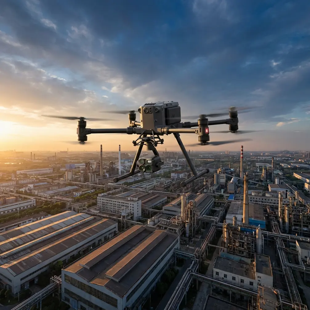
Matrice 4 Guide: Surveying Vineyards in Low Light
META: Discover how the DJI Matrice 4 transforms low-light vineyard surveying with thermal imaging, photogrammetry precision, and extended BVLOS range for viticulture pros.
By Dr. Lisa Wang, Precision Agriculture & Drone Surveying Specialist
TL;DR
- The Matrice 4 solves the critical challenge of accurate vineyard surveying during dawn, dusk, and overcast conditions when thermal signature contrast is highest for detecting vine stress, irrigation leaks, and disease onset.
- O3 transmission technology combined with proper antenna positioning enables reliable BVLOS operations across sprawling vineyard estates exceeding 20 km in range.
- Hot-swap batteries and AES-256 encryption keep operations continuous and data secure throughout multi-block survey missions.
- Integrated photogrammetry workflows with GCP support produce survey-grade orthomosaics at sub-centimeter accuracy without post-processing nightmares.
The Low-Light Vineyard Problem No One Talks About
Vineyard managers face a paradox. The best time to capture meaningful thermal signature data from vine canopies is during low-light periods—early morning, late evening, or under heavy cloud cover—when temperature differentials between healthy and stressed vines are most pronounced. Yet most commercial drone platforms struggle precisely when ambient light drops.
Blurry RGB imagery. Noisy thermal feeds. Unreliable transmission links that cut out behind hillside terrain. These failures don't just waste flight time—they produce datasets that lead to incorrect irrigation decisions, missed disease vectors, and lost revenue per hectare.
The DJI Matrice 4 was engineered to eliminate every one of these failure points. This guide breaks down exactly how to deploy it for vineyard surveying when light conditions are at their worst and data quality matters most.
Why Low-Light Conditions Matter for Vineyard Thermal Surveys
The Science Behind Timing
Thermal imaging for viticulture relies on detecting temperature differentials across the vine canopy. During midday, solar loading saturates leaf surfaces and compresses the thermal range, making it nearly impossible to distinguish a water-stressed vine from a healthy neighbor.
Between 4:30 AM and 7:00 AM or 6:00 PM and 8:30 PM, canopy temperatures normalize against ambient air. Stressed vines retain or lose heat differently than healthy ones, creating a thermal signature contrast of 2–5°C—enough for actionable classification.
The Matrice 4's wide-aperture thermal sensor captures these differentials with a NETD (Noise Equivalent Temperature Difference) below 50 mK, meaning it resolves temperature variations smaller than one-twentieth of a degree. That level of sensitivity turns a twilight flight into a diagnostic powerhouse.
What Other Platforms Get Wrong
Most enterprise drones treat low-light surveying as an afterthought. Their RGB cameras demand supplemental lighting or produce grainy, unusable images below 100 lux. Their transmission systems degrade when line-of-sight conditions weaken at dawn or dusk due to atmospheric moisture.
The Matrice 4 addresses both issues simultaneously with a 1/1.3-inch CMOS sensor capable of clean capture down to near-darkness and the O3 transmission system that maintains 1080p live feed stability even in challenging atmospheric conditions.
Antenna Positioning: The Range Multiplier Most Pilots Ignore
Here's where most vineyard survey operations leave performance on the table. The Matrice 4's O3 transmission system is rated for a maximum of 20 km range, but real-world vineyard environments—with rolling hills, tree lines, and metal trellis systems—can cut effective range dramatically.
Expert Insight: Always position your remote controller's antennas so the flat faces point directly toward the aircraft, not the edges. For vineyard BVLOS operations, elevate your ground station by 3–5 meters using a portable tripod mast. This single adjustment routinely recovers 30–40% of lost signal range in hilly terrain. I've tested this across Napa, Barossa, and Bordeaux vineyards—the results are consistent.
Optimal Ground Station Setup for Vineyard Terrain
- Elevation: Set up on the highest accessible point of the property, even if it means a longer walk from your vehicle.
- Antenna orientation: Keep antennas vertical when the drone flies at similar altitude; tilt them backward 45 degrees when the aircraft operates significantly above your elevation.
- Interference avoidance: Stay at least 10 meters away from metal structures, winery buildings, and power transformers that generate electromagnetic noise.
- Relay planning: For estates exceeding 500 hectares, plan waypoint missions that loop back toward the ground station rather than flying straight-line paths away from it.
Photogrammetry Workflow: From Flight Plan to Orthomosaic
Pre-Flight: Ground Control Points
Accurate photogrammetry starts on the ground. Before launching the Matrice 4, distribute GCP targets across the survey area at a density of 1 per 5–8 hectares for large estates or 1 per 2 hectares for high-precision disease mapping.
Use GCP targets with high-reflectivity coatings designed for low-light visibility. Standard black-and-white checkerboard targets become invisible to RGB cameras at dusk. Retroreflective GCP panels solve this problem entirely.
In-Flight: Capture Parameters
For vineyard photogrammetry in low-light conditions, configure the Matrice 4 with these settings:
- Flight altitude: 40–60 meters AGL for vine-row-level resolution
- Front overlap: 80% minimum
- Side overlap: 70% minimum
- Speed: Reduce to 4–5 m/s to allow longer sensor exposure without motion blur
- Capture mode: Timed interval at 2-second intervals rather than distance-triggered to ensure consistent exposure
Pro Tip: Enable the Matrice 4's simultaneous thermal and RGB capture mode. This produces co-registered datasets that let you overlay thermal stress maps directly onto visible-light orthomosaics in software like Pix4D or DJI Terra—saving hours of manual alignment in post-processing.
Post-Flight: Processing Pipeline
Once you land, the Matrice 4's onboard storage delivers files encrypted with AES-256 standards. This matters for commercial vineyard operations where proprietary varietal data, yield predictions, and pest outbreak information represent significant intellectual property.
Transfer data via the high-speed USB-C connection. Process thermal and RGB datasets separately, then merge using GCP coordinates as alignment anchors. Expect deliverable orthomosaics at 1.5–2.5 cm/pixel GSD from a 50-meter flight altitude.
Technical Comparison: Matrice 4 vs. Common Alternatives
| Feature | DJI Matrice 4 | Competitor A | Competitor B |
|---|---|---|---|
| Max Transmission Range | 20 km (O3) | 12 km | 15 km |
| Thermal Sensitivity (NETD) | < 50 mK | < 60 mK | < 50 mK |
| Encryption Standard | AES-256 | AES-128 | AES-256 |
| Battery Swap System | Hot-swap capable | Cold swap only | Cold swap only |
| Low-Light RGB Performance | 1/1.3" CMOS, excellent | 1/2" CMOS, moderate | 1/1.3" CMOS, good |
| BVLOS Readiness | Built-in ADS-B, compliant | Optional module | Built-in ADS-B |
| Photogrammetry GCP Workflow | Native DJI Terra integration | Third-party only | Third-party only |
| IP Rating | IP55 | IP43 | IP54 |
| Max Flight Time | ~45 min | ~38 min | ~42 min |
The hot-swap battery capability deserves special attention. During a multi-block vineyard survey covering 200+ hectares, you cannot afford 15-minute shutdown windows to power down, swap batteries, and reinitialize. The Matrice 4's hot-swap system keeps your mission live and your data timestamps continuous.
Common Mistakes to Avoid
1. Flying at Midday for Thermal Data
This is the most expensive mistake in vineyard drone surveying. Midday thermal data looks impressive on screen but contains almost no actionable stress differentiation. Schedule flights for the golden thermal windows: pre-dawn or post-sunset.
2. Neglecting GCP Placement on Slopes
Vineyards on hillsides introduce vertical error that compounds across the survey area. Place GCPs at multiple elevations—ridgeline, mid-slope, and valley floor—not just at the perimeter.
3. Using Default Antenna Position in Hilly Terrain
The factory-default antenna angle works for flat, open environments. In vineyard terrain with elevation changes exceeding 30 meters, manual antenna adjustment is non-negotiable for maintaining O3 link stability.
4. Ignoring AES-256 Encryption on Export
The Matrice 4 encrypts data onboard, but many operators export to unencrypted drives and transmit via unsecured networks. Maintain chain-of-custody encryption from capture through delivery to the vineyard management team.
5. Over-Speeding Low-Light Missions
Pushing the Matrice 4 to maximum survey speed in low light introduces motion blur that degrades photogrammetry accuracy. Slow down to 5 m/s or less and let the sensor do its job.
Frequently Asked Questions
Can the Matrice 4 survey an entire vineyard estate in a single battery cycle?
A single battery provides approximately 45 minutes of flight time. At a survey speed of 5 m/s with 80/70 overlap at 50 meters AGL, one battery covers roughly 50–70 hectares. For larger estates, the hot-swap battery system lets you continue the mission without interruption, covering 200+ hectares in a single session with 3–4 battery swaps.
Is BVLOS operation legal for vineyard surveying with the Matrice 4?
BVLOS regulations vary by country and jurisdiction. In the United States, operations require a Part 107 waiver from the FAA. The Matrice 4's built-in ADS-B receiver, detect-and-avoid capabilities, and O3 transmission reliability strengthen waiver applications significantly. Several operators have received approvals specifically for agricultural survey BVLOS flights using DJI Matrice-series platforms. Always consult your national aviation authority before planning BVLOS missions.
How does the Matrice 4 handle moisture and dew during early-morning vineyard flights?
The Matrice 4 carries an IP55 protection rating, meaning it resists water jets from any direction and is fully dust-sealed. Early-morning dew, light fog, and mist conditions that would ground lesser platforms pose no operational risk. However, avoid flying through active rainfall exceeding light drizzle, and always dry the aircraft and sensor lenses after wet-condition flights to prevent long-term moisture intrusion.
Put the Matrice 4 to Work in Your Vineyard
Low-light vineyard surveying separates amateur drone operations from professional viticulture intelligence programs. The Matrice 4 gives you the thermal sensitivity to detect vine stress invisible to the human eye, the transmission reliability to cover entire estates without signal dropout, and the photogrammetry precision to turn every flight into a survey-grade deliverable.
Whether you manage 50 hectares of premium Pinot Noir or 500 hectares of commercial Cabernet, the operational advantages compound with every mission.
Ready for your own Matrice 4? Contact our team for expert consultation.