How I’d Survey Dusty Vineyards With Matrice 4
How I’d Survey Dusty Vineyards With Matrice 4: A Field Method That Protects Data, Airframe, and Yield Decisions
META: A practical Matrice 4 vineyard surveying workflow for dusty conditions, covering photogrammetry, thermal signature capture, GCP strategy, transmission reliability, fatigue-aware operations, and safer repeatable results.
Vineyards punish sloppy drone workflows.
They look tidy from the road, but once you’re in the rows, the mission gets complicated fast: drifting dust, repetitive geometry, uneven terrain, reflective leaves, temperature swings, and long linear flight paths that expose every weakness in mission planning. If the aircraft is going to earn its place here, it needs to do more than fly a grid. It has to stay stable in bad visibility, preserve image consistency, carry a reliable signal down long corridors of vines, and come home with data you can trust when irrigation, disease pressure, or canopy variability are on the line.
That is where I’d frame the Matrice 4 discussion for vineyard operators. Not around hype. Around repeatability.
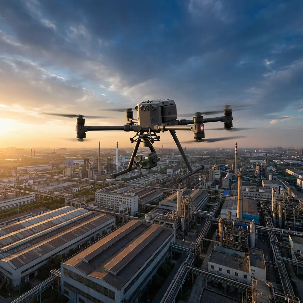
I’ve watched this play out in real field conditions. On one dust-heavy survey near a dry access track, a hare burst from the edge of a row just as the aircraft was transitioning toward the next leg. The important part wasn’t the animal encounter itself. It was that the sensor stack still held the mission together: visual context, thermal signature awareness, and stable route execution meant the aircraft didn’t wander into the row structure or lose survey consistency while the pilot assessed the scene. In vineyard work, that kind of calm sensor behavior matters more than brochure specs.
Start with the mission objective, not the aircraft
Most vineyard teams say they want “a survey,” but that can mean very different deliverables:
- a high-resolution orthomosaic for vine count or row condition
- a thermal map for irrigation anomalies
- a terrain model for runoff analysis
- a repeatable time-series dataset to compare blocks over a season
The Matrice 4 only becomes useful when you define which of those outcomes matters first. A photogrammetry mission and a thermal stress mission should not be flown the same way, even in the same vineyard on the same day.
For standard photogrammetry, your main enemy in dusty vineyards is inconsistency. Dust haze softens contrast. Repetitive vine rows reduce unique tie points. Variable sunlight creates banding in the dataset if you fly too slowly through changing conditions. So the mission has to be built around clean image overlap, stable speed, and good control on ground reference.
For thermal work, the concern shifts. You care less about pretty imagery and more about whether the thermal signature is meaningful. That means timing the flight when canopy temperature differences actually reveal water stress, blocked emitters, weak zones, or disease-related changes.
Why dusty conditions change the way you should use Matrice 4
Dust isn’t just a maintenance nuisance. It affects navigation confidence, moving parts, optics, and mission rhythm.
This is where old-school aircraft design logic is surprisingly relevant. One of the reference points worth borrowing from legacy aircraft control-system design is the insistence on guiding and protecting cable runs so they do not rub, snag, or drift into adjacent structures. That same mindset applies directly to drone field operations in vineyards: anything exposed to abrasive contact or misalignment degrades faster than you expect. Dust acts like a fine grinding compound. It gets into hinges, gimbal surroundings, landing gear interfaces, battery contacts, and transport cases. If your workflow allows contamination to build between sorties, you are quietly increasing mechanical risk and reducing data quality.
Another useful engineering detail from the source material concerns thermal expansion and tension control. The manual describes a spring-based tension regulator that prevents cable tension from rising too much at high temperature and dropping too much at low temperature. That idea matters in vineyard drone work because dusty vineyard operations often start cool and end hot. Temperature shift changes battery behavior, can alter handling feel, and influences sensor interpretation—especially thermal. The practical lesson is simple: don’t treat the morning mission and the afternoon mission as equivalent. The platform, the environment, and the data are all operating under different conditions.
My field workflow for vineyard photogrammetry with Matrice 4
If I were running Matrice 4 over vineyards in dusty terrain, I would use a workflow built around five stages.
1. Walk the block before launch
I want eyes on:
- loose dust sources such as access roads and turnarounds
- irrigation hardware near takeoff zones
- trellis wires and anti-bird netting
- slope transitions
- gaps in vine rows
- people, vehicles, and animals moving through the parcel
Dusty vineyards often tempt crews to launch from the nearest road shoulder. That’s usually the wrong choice. Pick a cleaner staging point, even if it adds a few minutes of setup. Less airborne dust at takeoff and landing protects optics and reduces contamination on batteries and connectors.
If the block is long and narrow, I also want to understand whether O3 transmission will be challenged by terrain, trees, outbuildings, or row orientation. A signal spec means little if your route keeps placing the aircraft behind small but persistent obstructions. In vineyards, line continuity matters.
2. Set GCPs like you actually plan to defend the map later
A lot of vineyard maps look sharp and still fail operationally because nobody built the control correctly.
Use GCPs where they stabilize the model, not where it’s convenient to toss them. In vineyards, I want them distributed across row direction changes, elevation differences, and block edges. Long narrow sites can distort if control is weak at the ends. Repetitive geometry is another reason to be disciplined here. Vine rows can fool a model into looking internally neat while drifting globally.
If the client is comparing vigor patterns between seasons, weak control undermines the entire exercise. A misaligned map does not become useful because it is colorful.
3. Separate RGB and thermal jobs unless there’s a strong reason not to
People often try to collect everything in one pass. Sometimes that works. Often it creates mediocre datasets in two modalities.
For photogrammetry, I want lighting that supports consistent texture extraction. For thermal, I want timing that makes canopy temperature variation interpretable. Depending on weather and crop stage, those windows may not match.
Thermal signature mapping in vineyards is easy to misuse. A hot patch may indicate stress, poor irrigation delivery, bare soil influence, disease pressure, or simply a timing artifact. The value comes from repeatability and context. If you can’t explain why a warm zone appears, you don’t yet have an agronomic insight; you have a question.
4. Use battery rhythm as part of data quality control
Hot-swap batteries are more than a convenience feature in production work. They protect continuity.
In dusty vineyards, every unnecessary power-down, relocation, or manual restart is another chance to introduce contamination, lose mission consistency, or drift away from your reference settings. With a hot-swap workflow, the crew can keep momentum without turning the job into a sequence of improvised interruptions.
That matters especially on larger vineyards where the goal is to hold capture conditions as steady as possible across adjacent blocks. If one section is flown under different light, temperature, and battery-state behavior, the stitched result may still process, but interpretation becomes harder.
I also recommend logging battery swaps against block segments. It sounds fussy. It pays off later when you’re troubleshooting odd exposure behavior or trying to explain an inconsistency in the dataset.
5. Build in a dust reset between sorties
Not a full teardown. A disciplined reset.
Check optics. Check vents and exposed surfaces. Check battery seating surfaces. Check landing gear and gimbal surroundings. Confirm no fine grit is building where repeated movement occurs.
Again, this echoes the source material’s emphasis on preventing friction, snagging, and misalignment in guided systems. Abrasion rarely announces itself dramatically at first. It accumulates.
Transmission, security, and long-row operations
Survey teams working vineyards increasingly care about two things at once: signal stability and data protection.
On the signal side, O3 transmission matters because vineyard surveys often involve extended linear paths where the aircraft can feel farther away than the map suggests. Row orientation, local terrain, shelterbelts, and farm structures can all create awkward RF behavior. Stable transmission is not just a comfort item for the pilot. It supports consistent mission oversight, cleaner intervention if wildlife or vehicles enter the area, and better confidence when capturing repeatable data near the limits of a block.
On the data side, AES-256 matters whenever imagery is commercially sensitive. Many vineyards do not want irrigation performance, plant stress patterns, trial block conditions, or infrastructure layout floating around unsecured devices. If a grower is using drone data to guide block-by-block decisions, that dataset has operational value. Protecting it is part of doing professional work, not an IT afterthought.
For teams planning future BVLOS-style workflows where regulations and approvals allow, both of these themes become even more important. Reliable link behavior and secure data handling are foundational habits long before a program scales.
Fatigue-aware flying: the overlooked lesson from helicopter design
One of the most useful ideas in the reference material has nothing to do with vineyards on the surface. It discusses fatigue evaluation using measured power histories, filtered data, rainflow counting, and load-spectrum refinement. It also notes that average power alone is not enough because alternating loads matter. In helicopter transmission analysis, those additional oscillating effects can add roughly 3% to 15% depending on where they occur in the system.
That detail deserves attention because drone crews often reduce aircraft stress to one simplistic thought: “the mission wasn’t long, so it wasn’t hard on the machine.”
Not true.
A vineyard survey in dust and summer heat can be mechanically harsher than a longer mission in calm, clean air. Repeated accelerations at row ends, persistent micro-corrections in unstable air, stop-start workflows, and thermal load on components all contribute to wear in ways average flight time does not reveal. The 3% to 15% figure from rotorcraft load thinking is a useful reminder that oscillation and vibration penalties are real engineering quantities, not abstract theory.
For Matrice 4 operators, the practical takeaway is to log more than total hours. Track:
- temperature bands
- wind conditions
- dust severity
- mission profile type
- repeated high-turn segments
- any unusual vibration or handling notes
If you only measure endurance, you miss the shape of the stress.
The wildlife problem nobody plans for
Back to that hare in the row.
Wildlife in vineyards is not rare. Birds flush from cover crops. Rabbits and hares sprint across open inter-row tracks. Deer appear at block margins. A capable sensor platform does not eliminate those encounters, but it gives the pilot more context for making good decisions without sacrificing the survey.
This is one place where combining thermal signature awareness with visible imaging can be genuinely useful. Not because you are “tracking” animals, but because situational awareness improves when the aircraft can help the operator distinguish warm moving subjects from static field clutter in marginal visibility or dusty light. In practical terms, that can reduce rushed control inputs and preserve the integrity of your planned line work.
A note on processing discipline
The best Matrice 4 vineyard survey is still fragile if processing gets sloppy.
Use consistent naming. Keep thermal and RGB datasets separated until you intentionally combine them. Document GCP placement. Record weather. Note irrigation state if known. Mark any block where dust plumes, vehicle movement, or wildlife interruptions affected capture.
When the final map shows an anomaly, you want enough field context to decide whether it reflects the vines, the environment, or the mission itself.
If your team is building a repeatable vineyard program and wants a second set of eyes on workflow design, mission planning, or block-specific data capture choices, you can message us directly here: https://wa.me/85255379740
What Matrice 4 needs to prove in vineyards
For vineyard operators, the Matrice 4 does not need to be exciting. It needs to be dependable in all the boring ways that protect data quality.
Can it hold a repeatable mission in dusty corridors? Can it support photogrammetry that stands up to agronomic comparison? Can it collect thermal data at the right time without turning every warm pixel into false confidence? Can it maintain clean transmission across long narrow parcels? Can the crew manage batteries, contamination, and field notes with enough discipline that the aircraft’s capability actually shows up in the final deliverable?
Those are the real tests.
The strongest drone programs in viticulture are not built on dramatic flights. They are built on small engineering habits repeated well: protecting components from abrasion, accounting for temperature effects, respecting vibration and fatigue, controlling ground reference, and treating sensor data as evidence rather than decoration.
That is how I would use a Matrice 4 in dusty vineyards. Not as a flying camera alone, but as a measured survey tool whose value depends on workflow discipline as much as hardware.
Ready for your own Matrice 4? Contact our team for expert consultation.